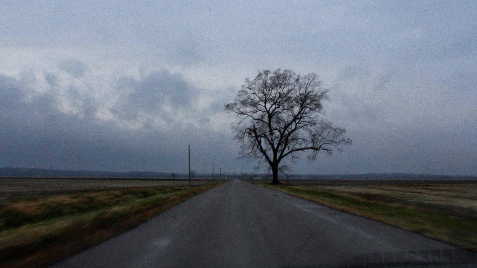
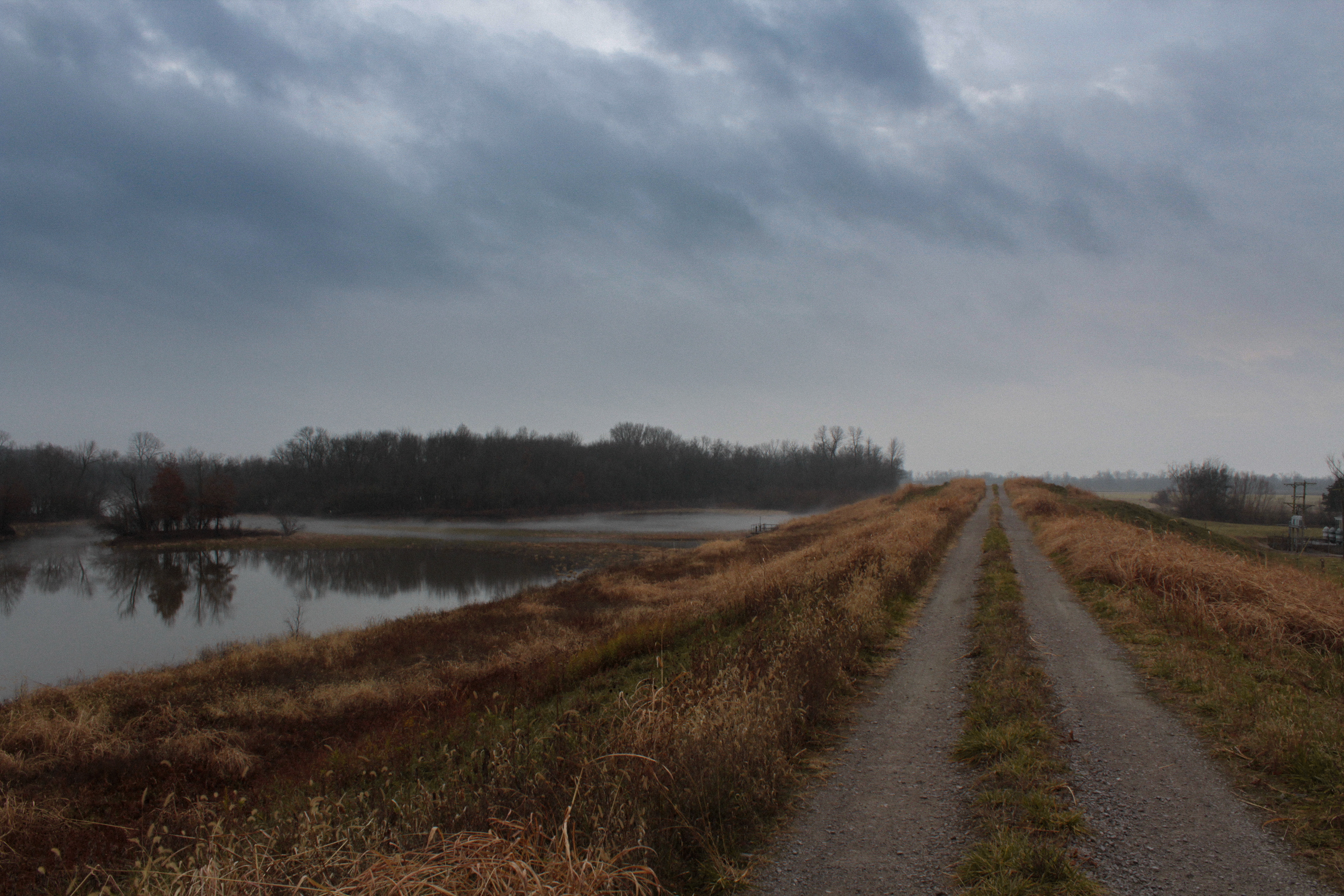
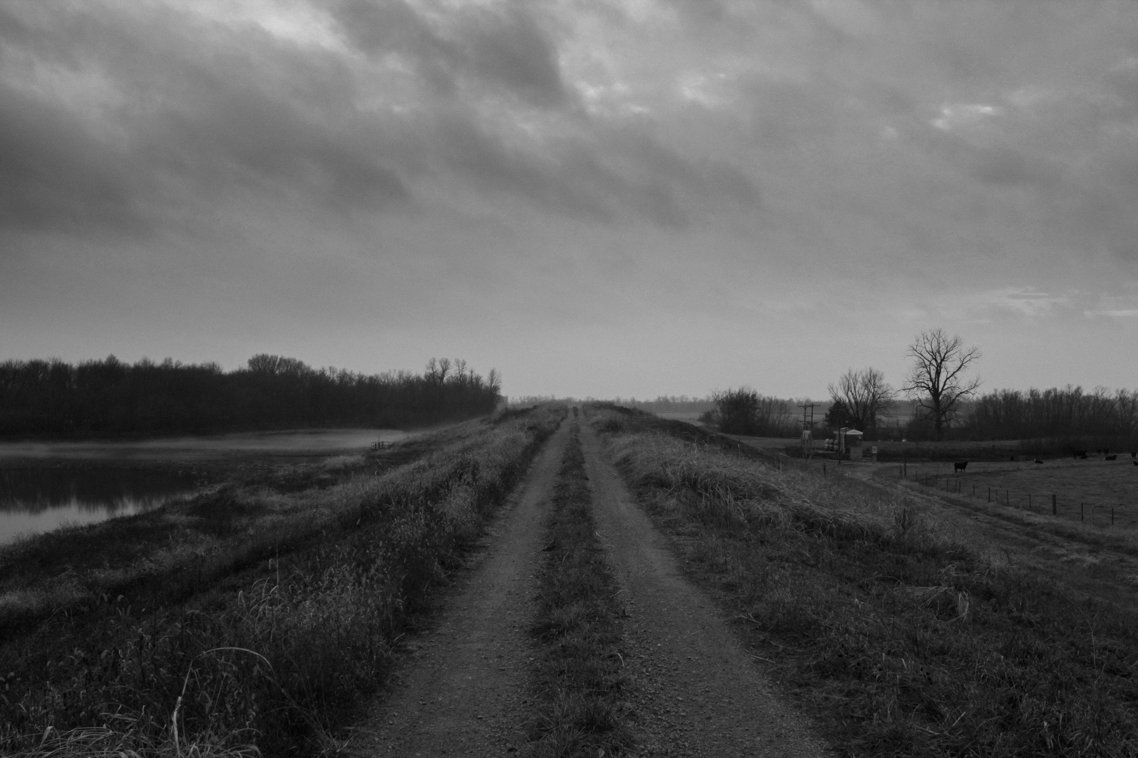
Kings Highway—Kaskaskia, IL
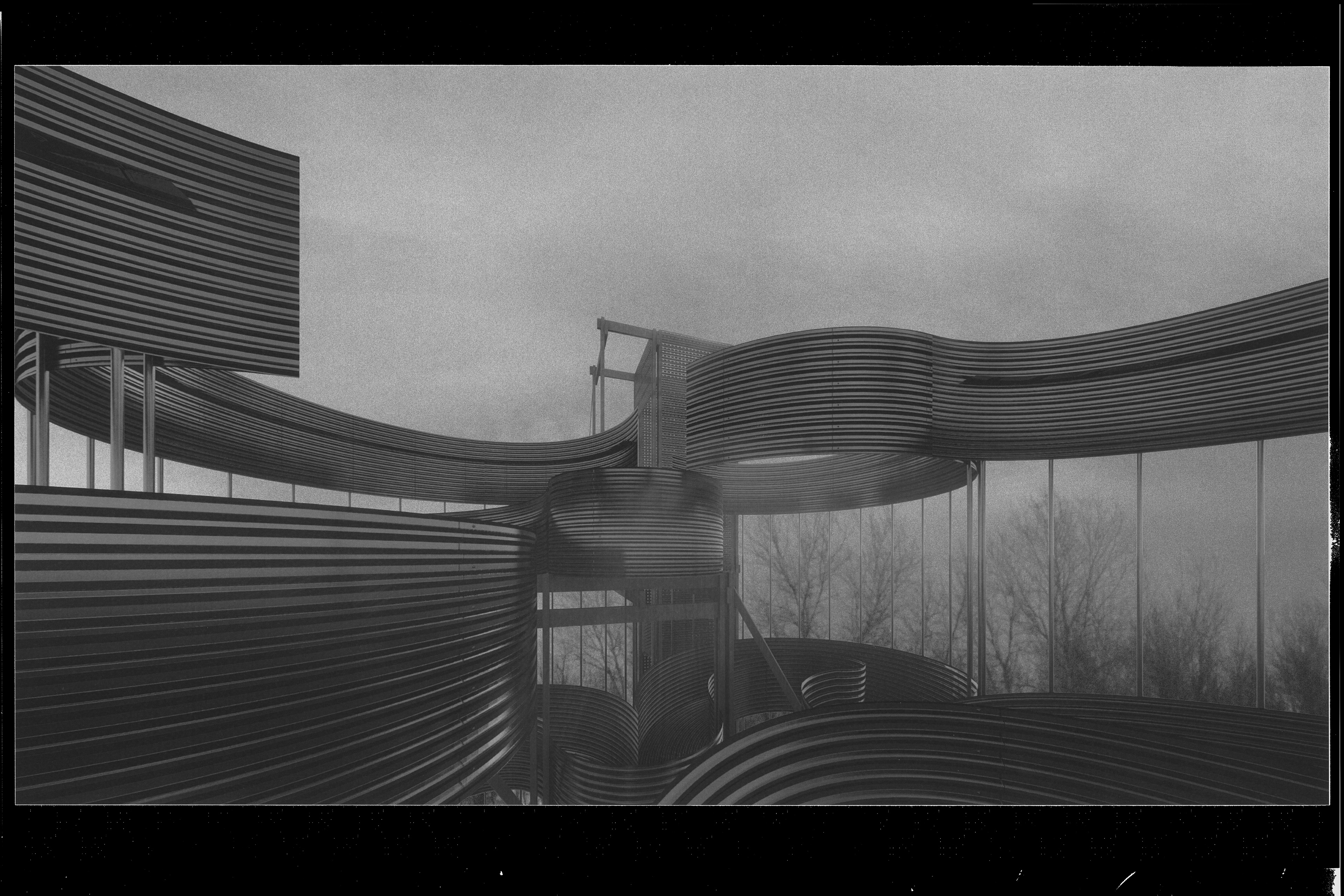
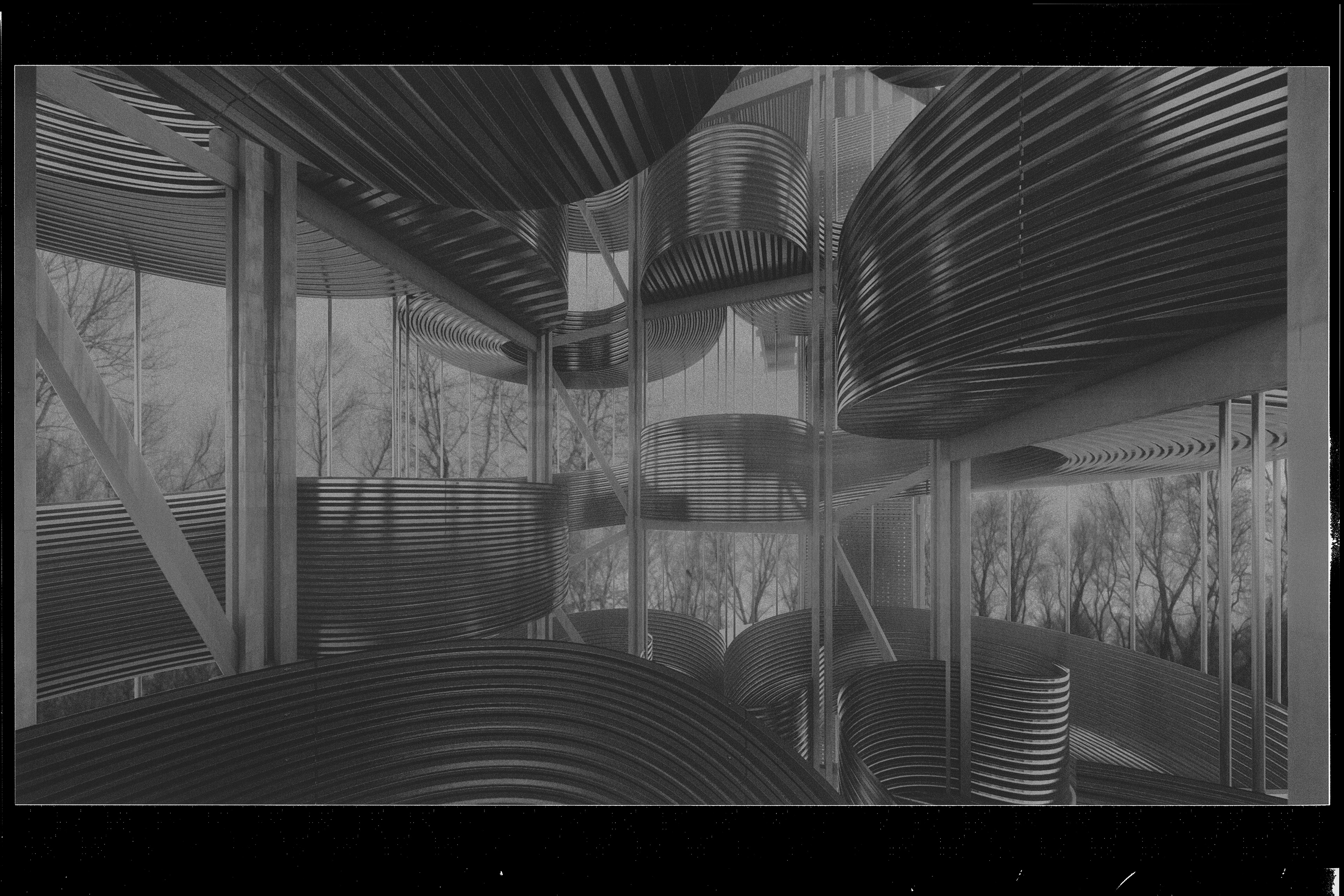
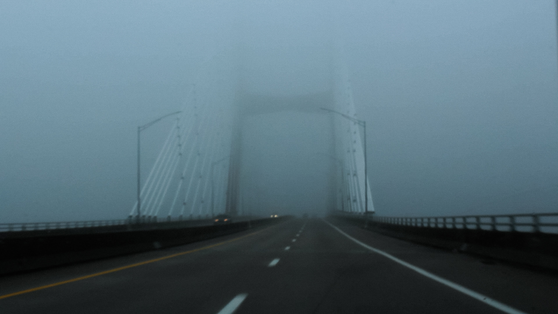
Approaching the Passetto—Kaskaskia, IL
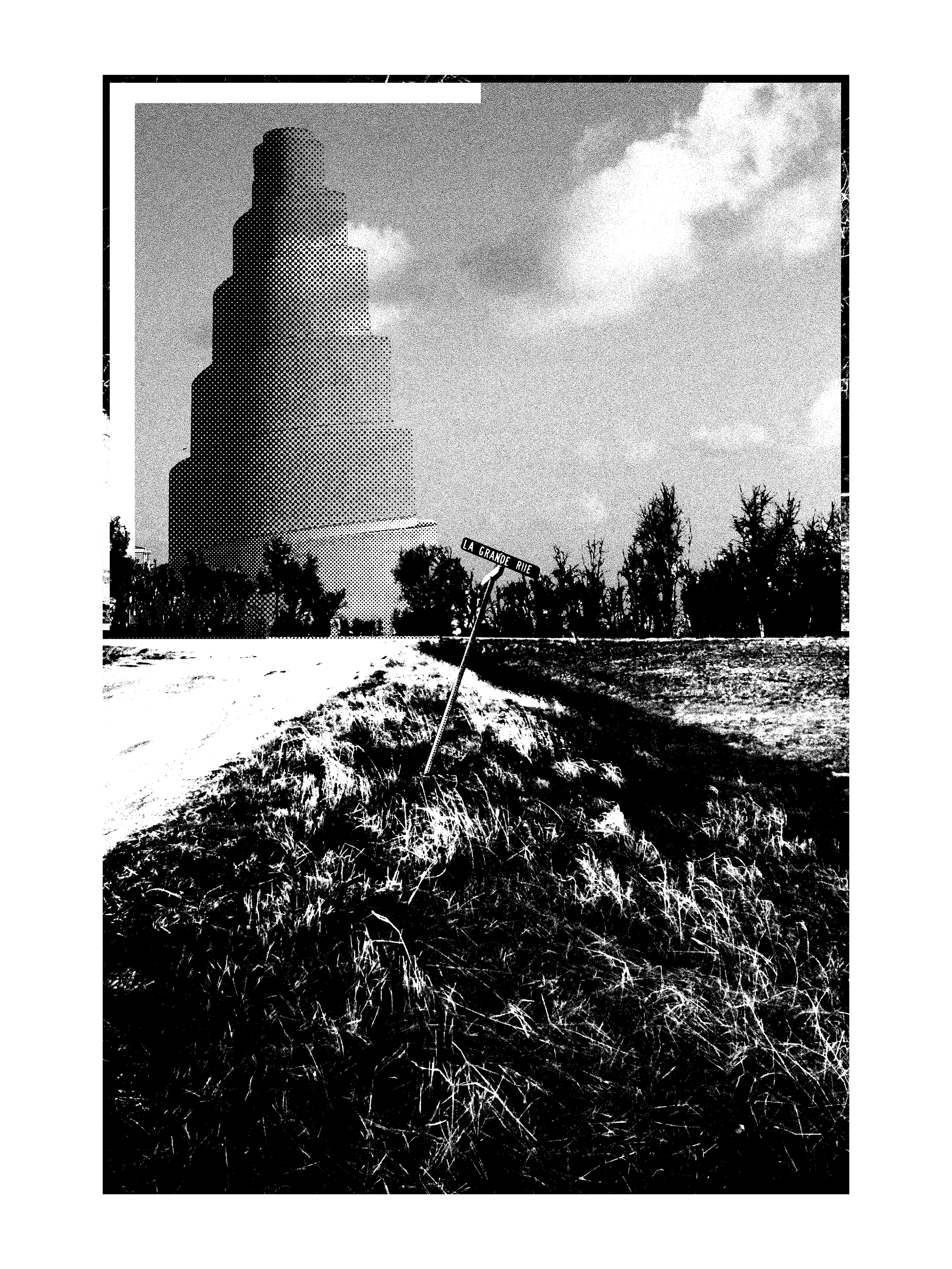
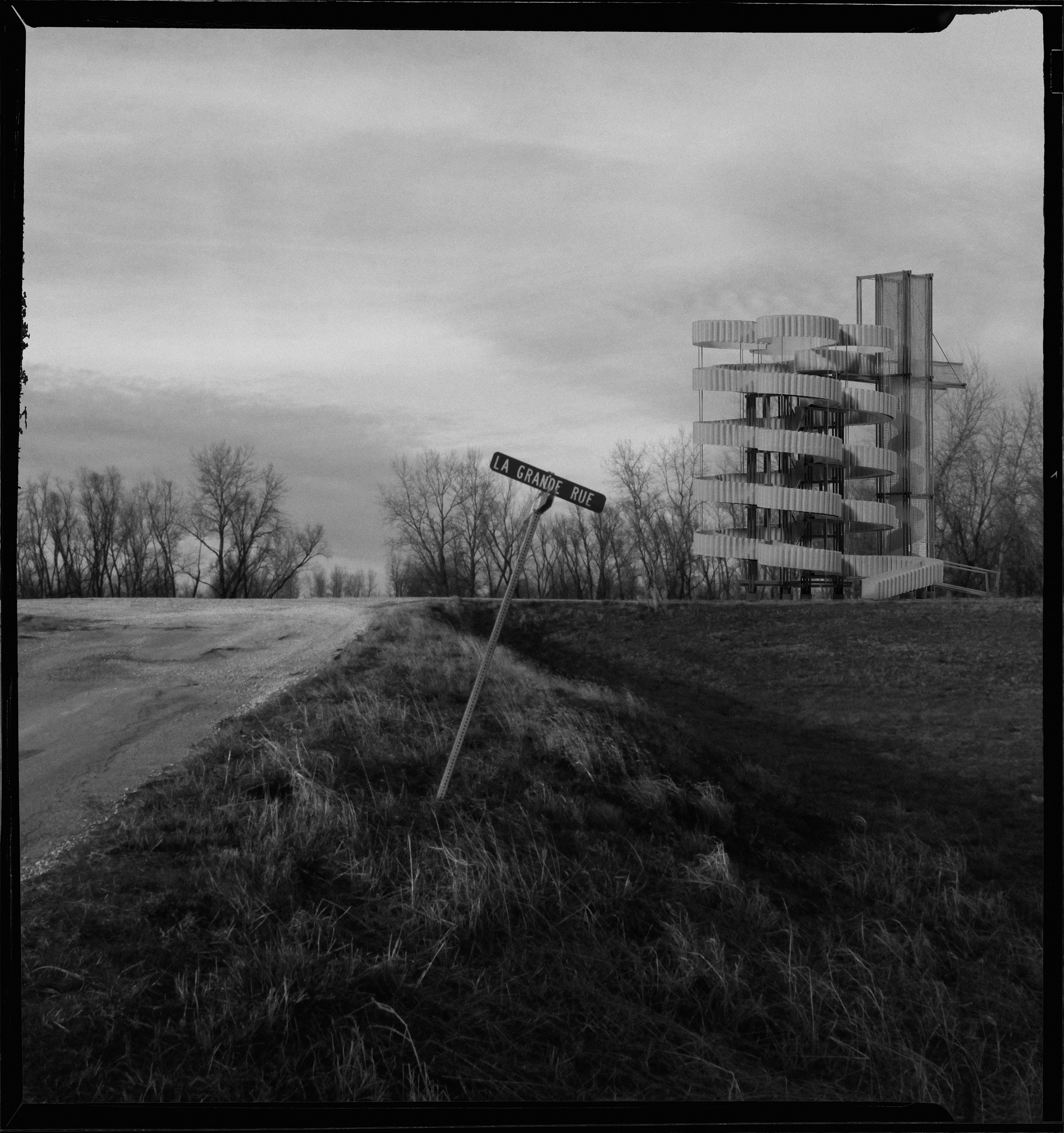
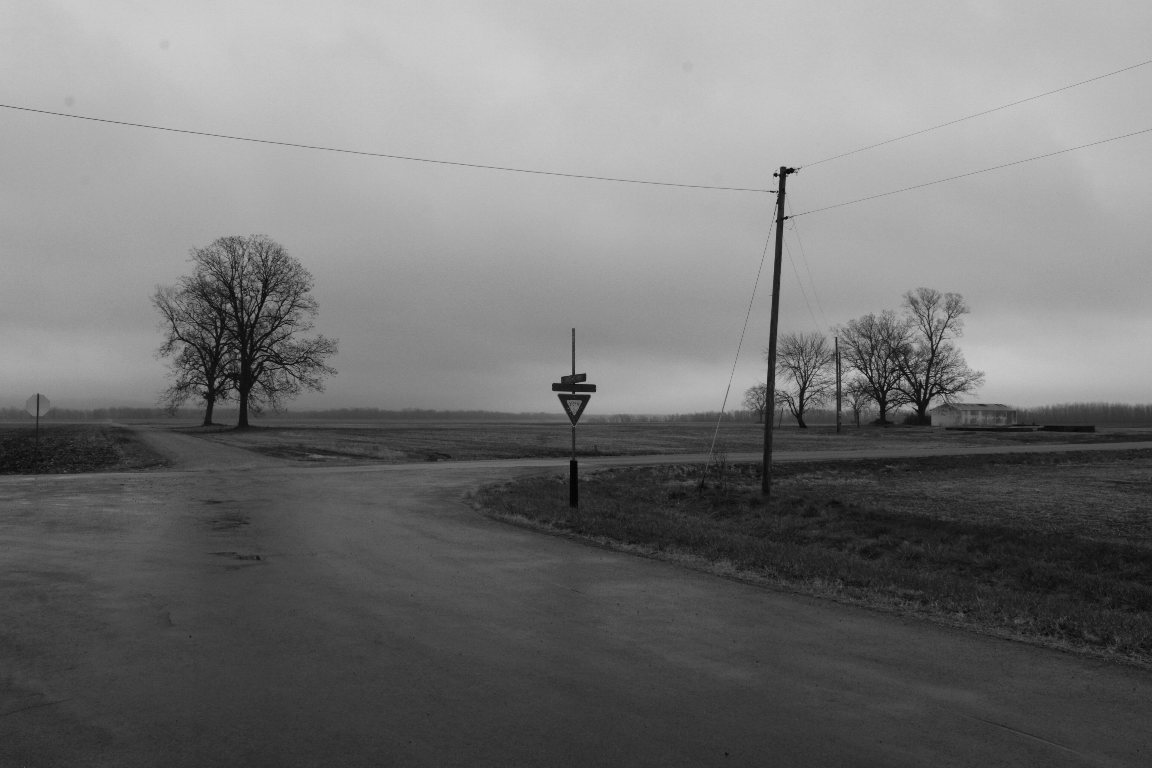
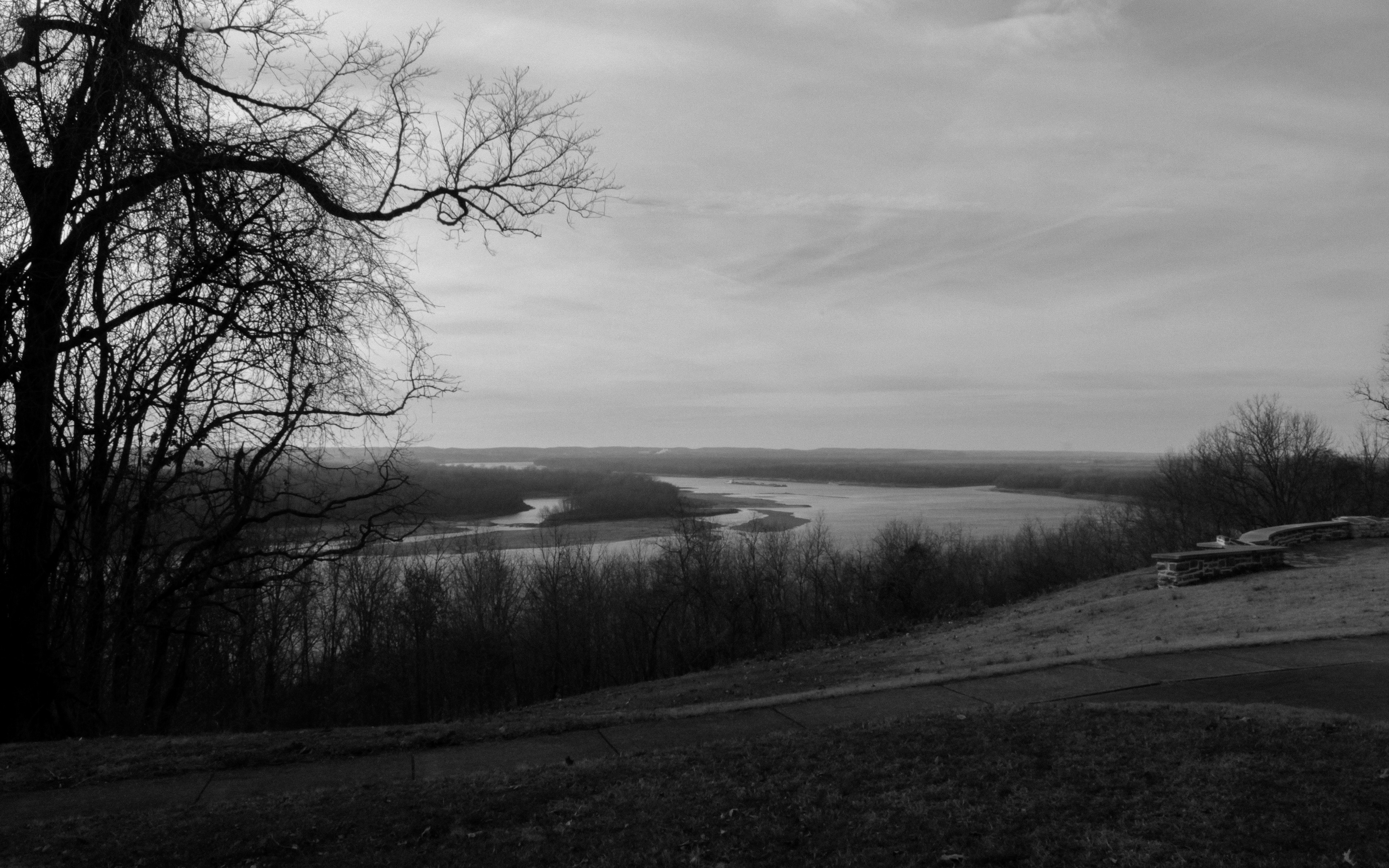
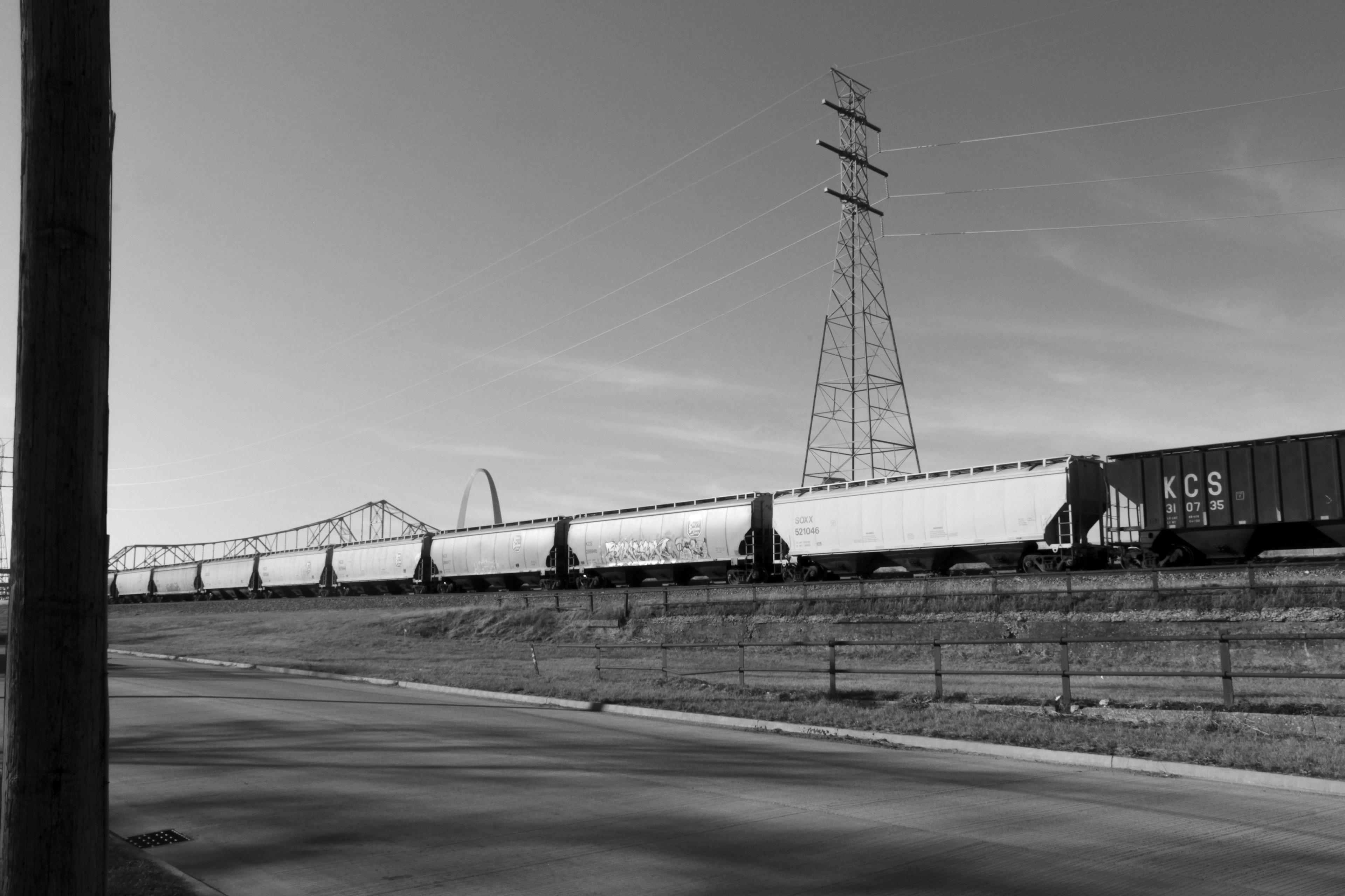
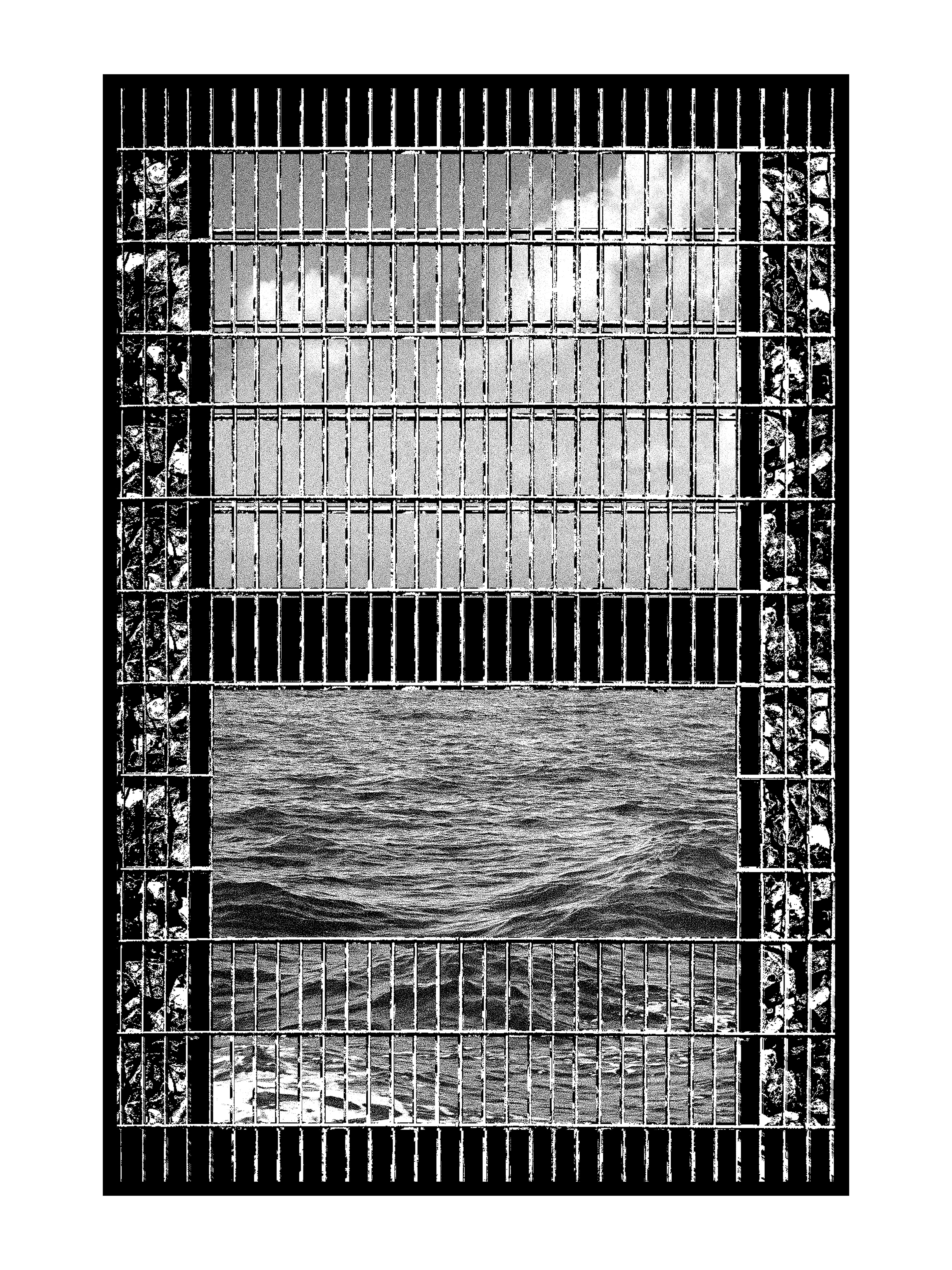
La Grande Rue—Kaskaskia, IL
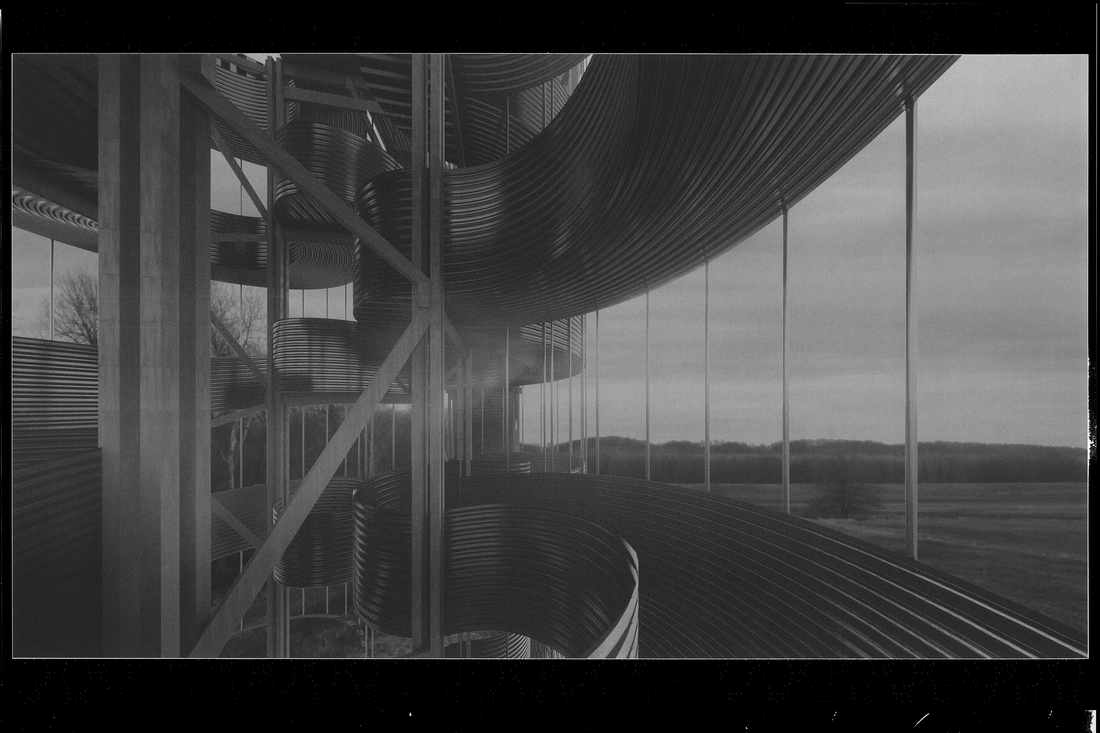
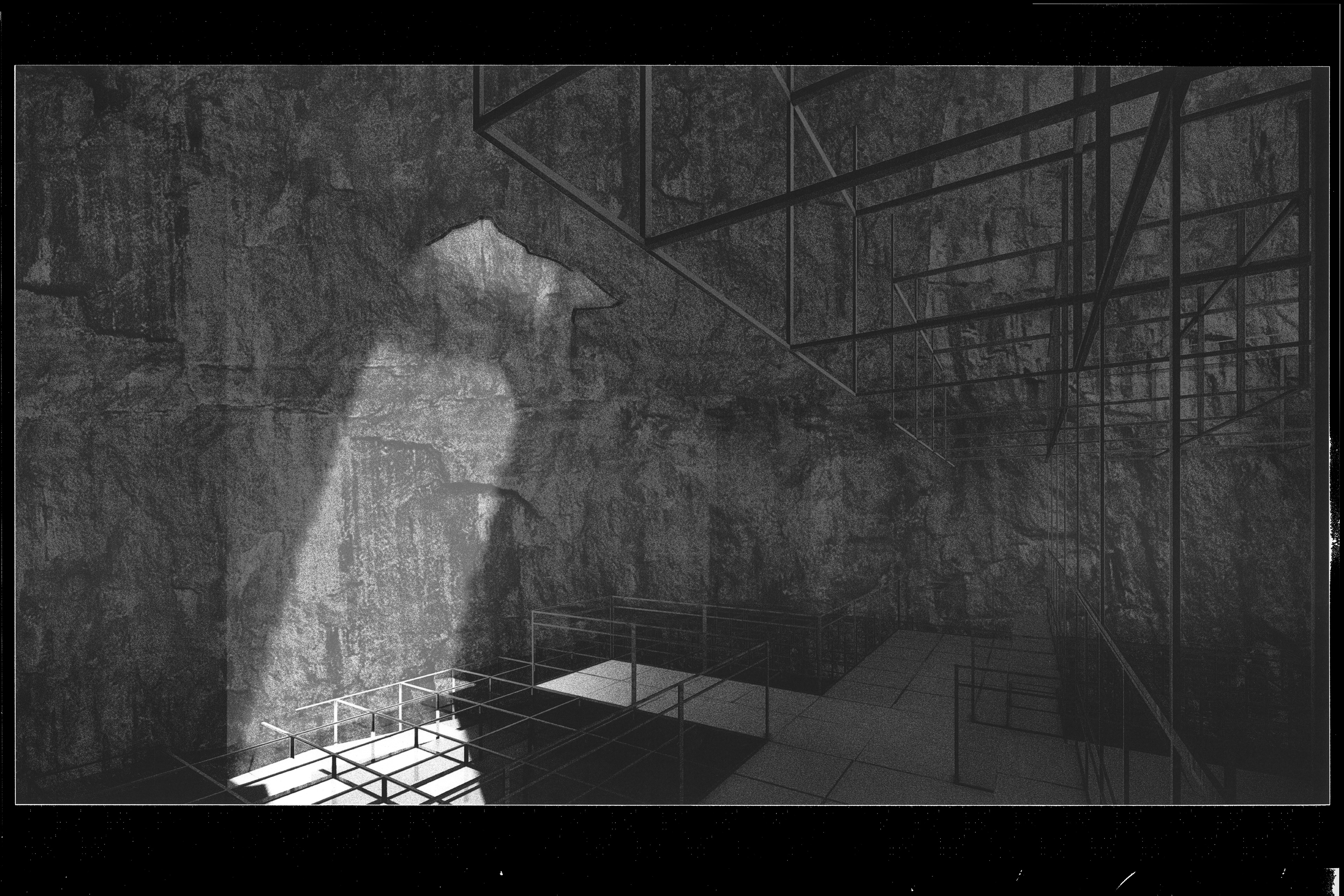
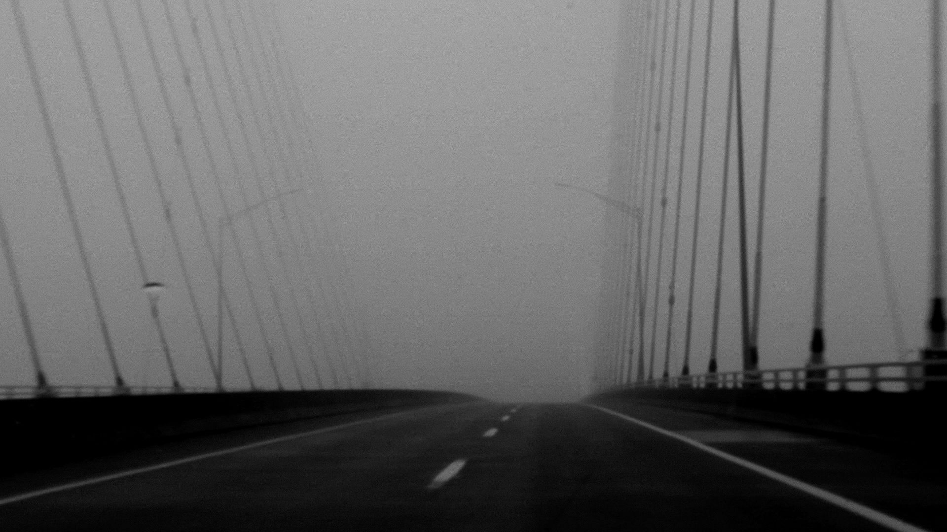
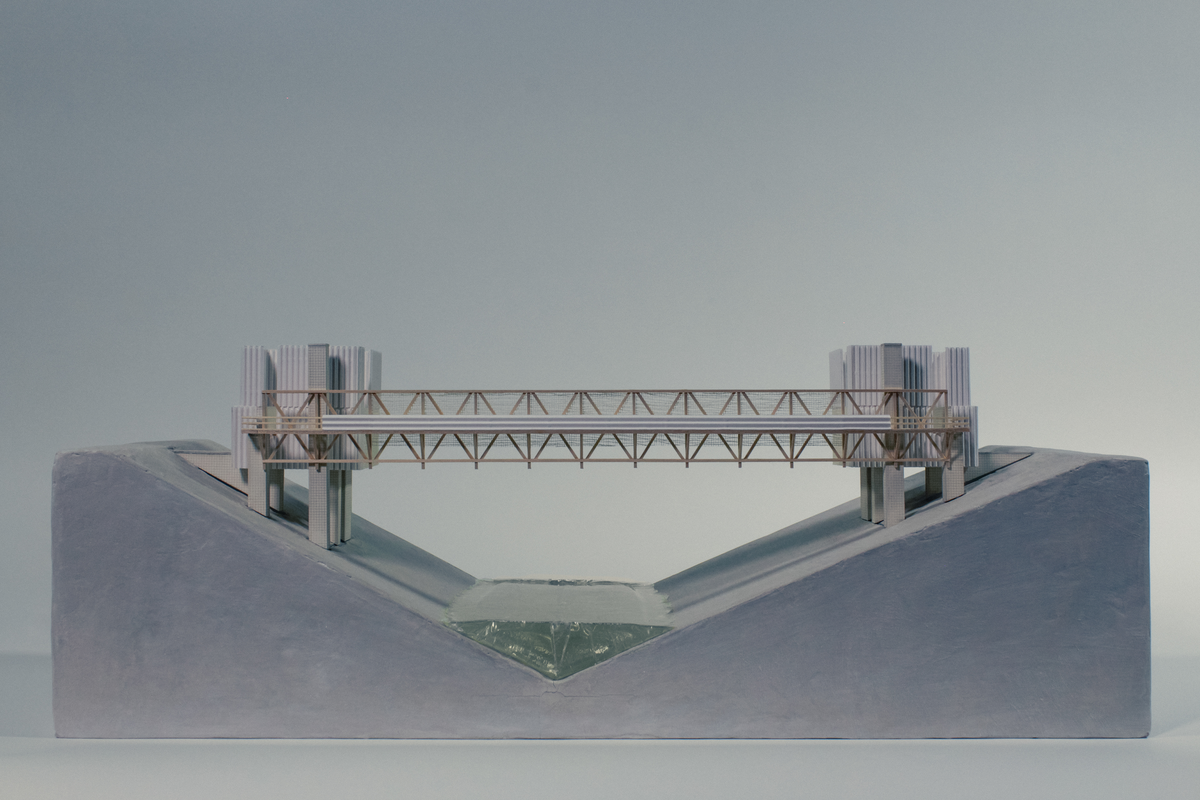
Ascending the Passetto—Kaskaskia, IL
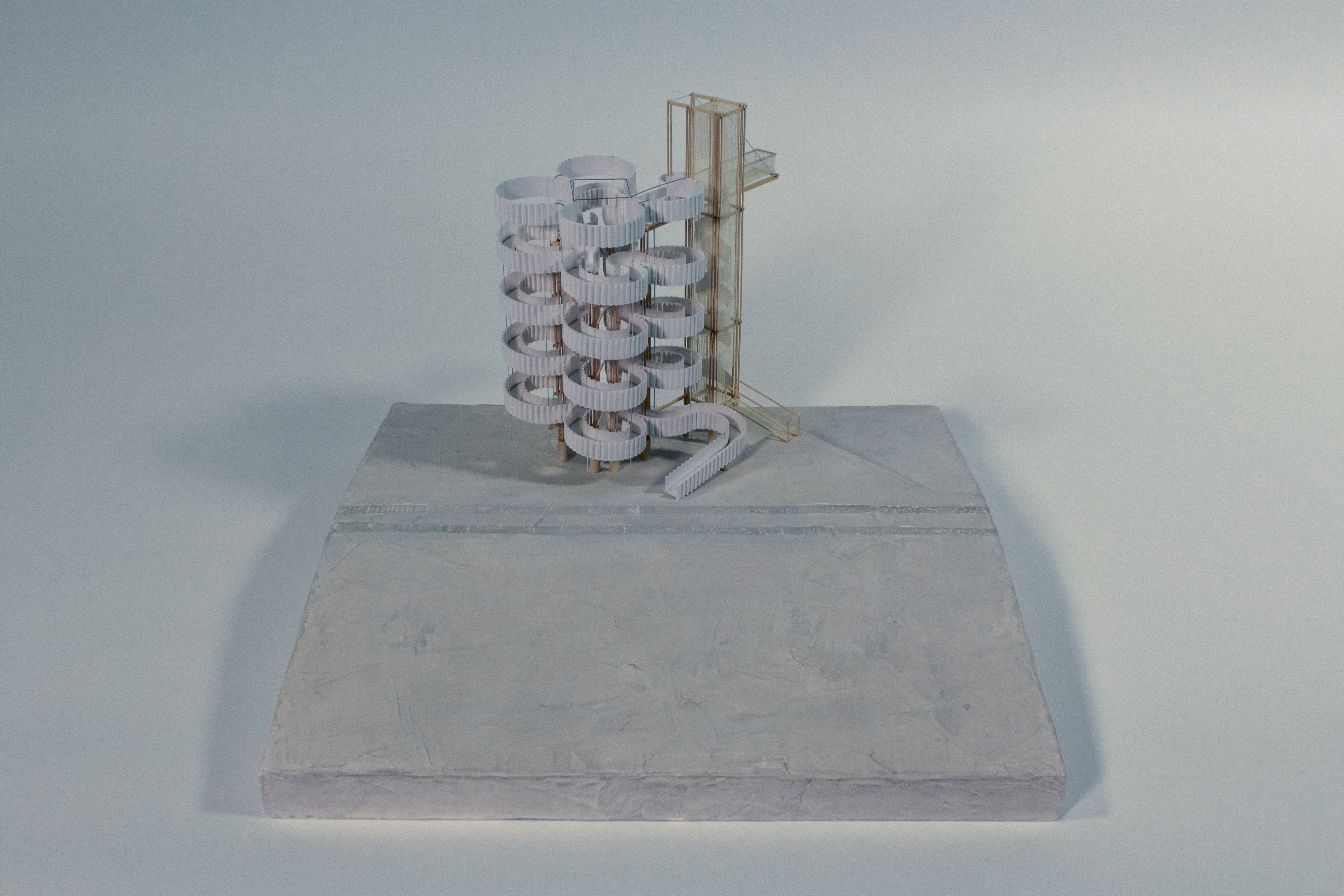
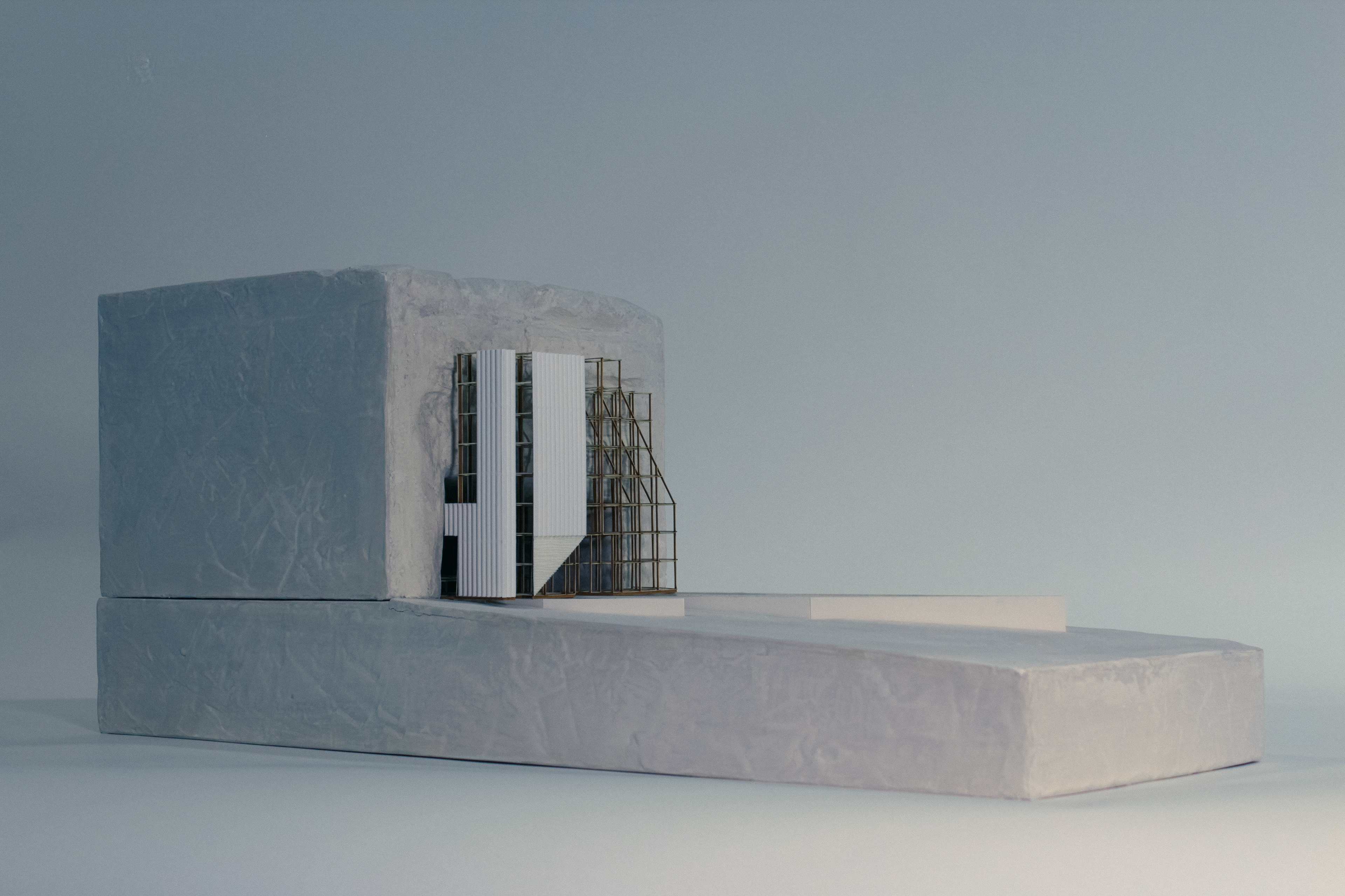
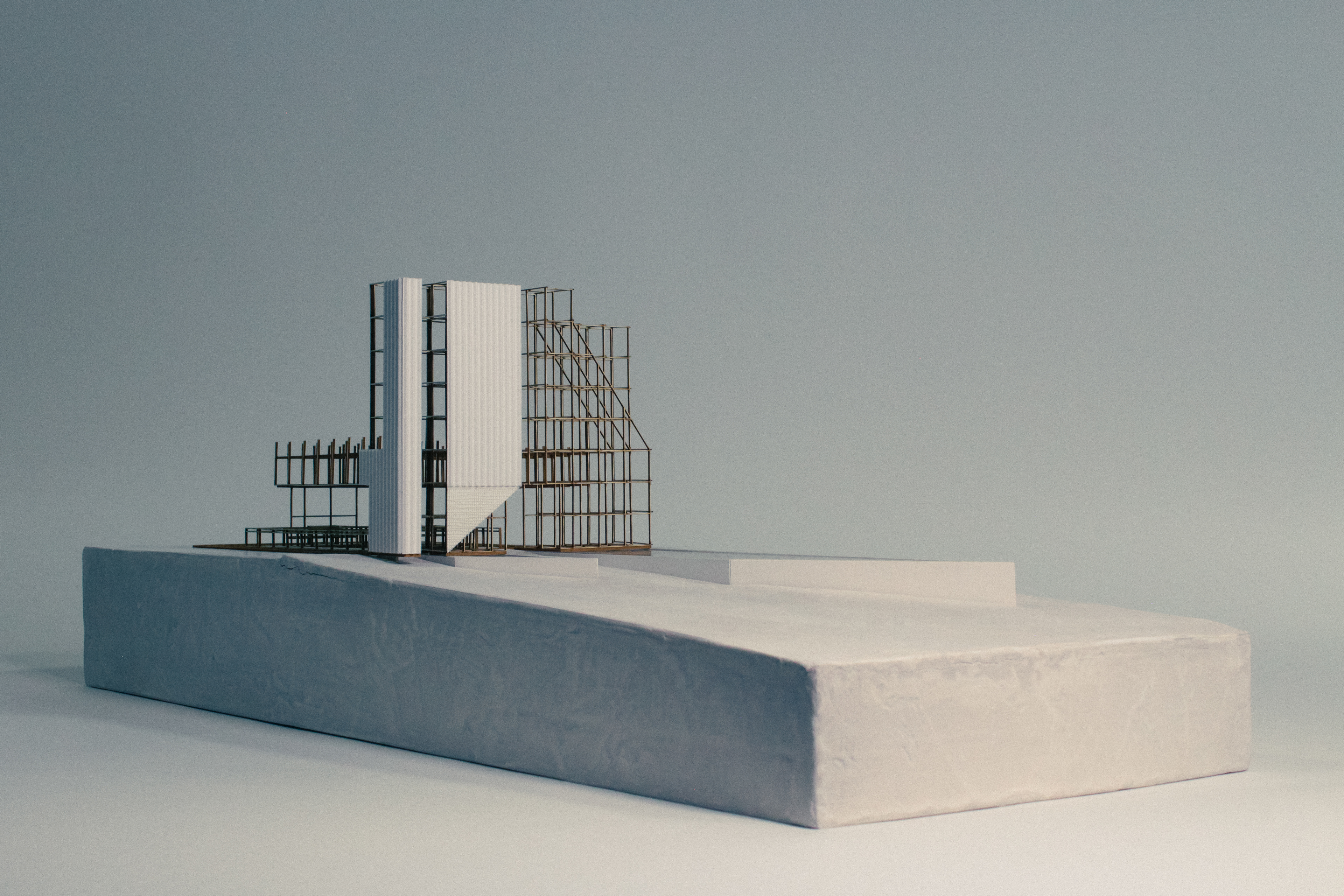
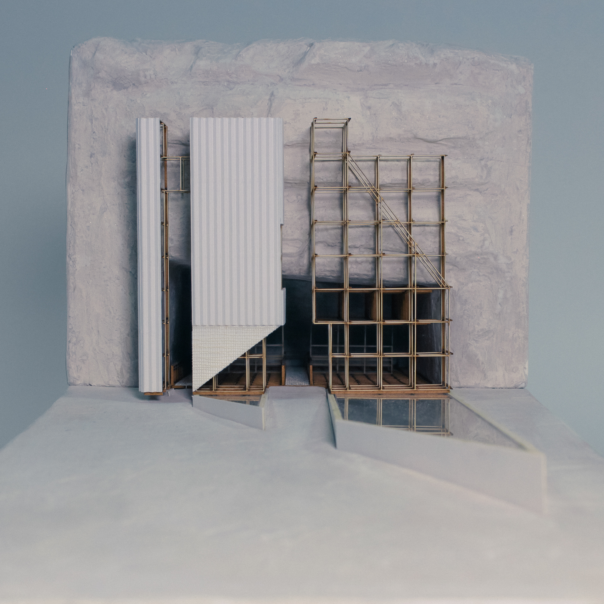
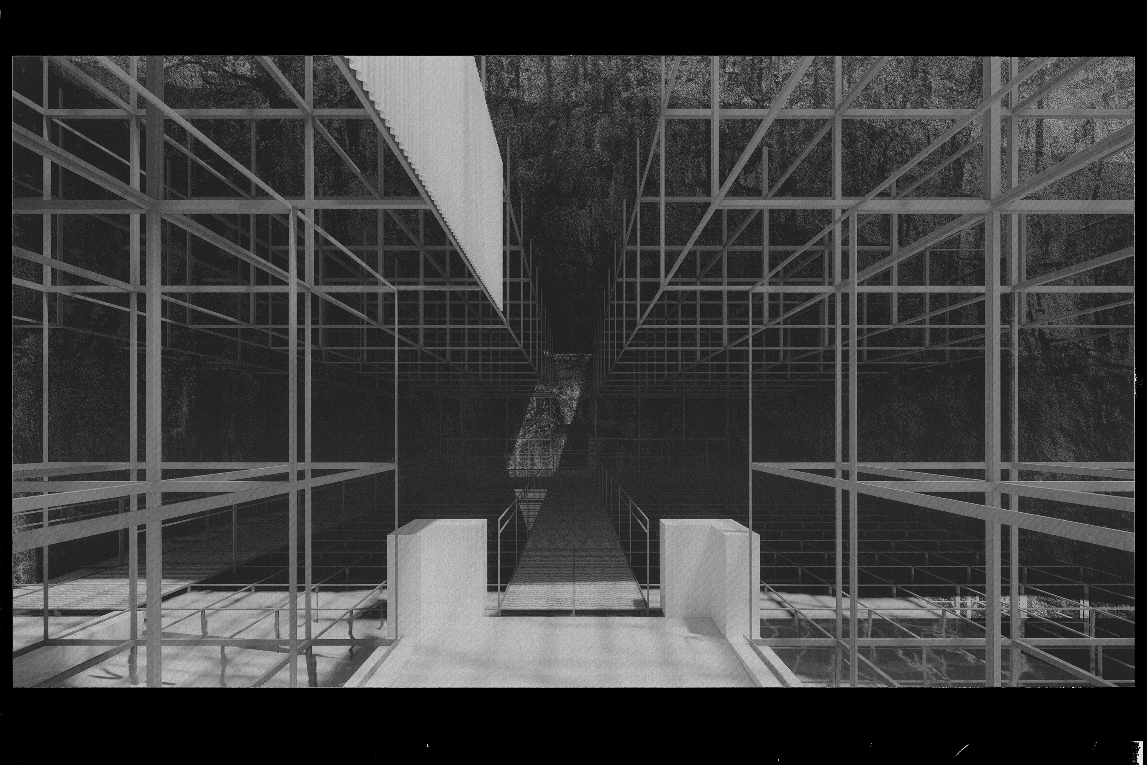
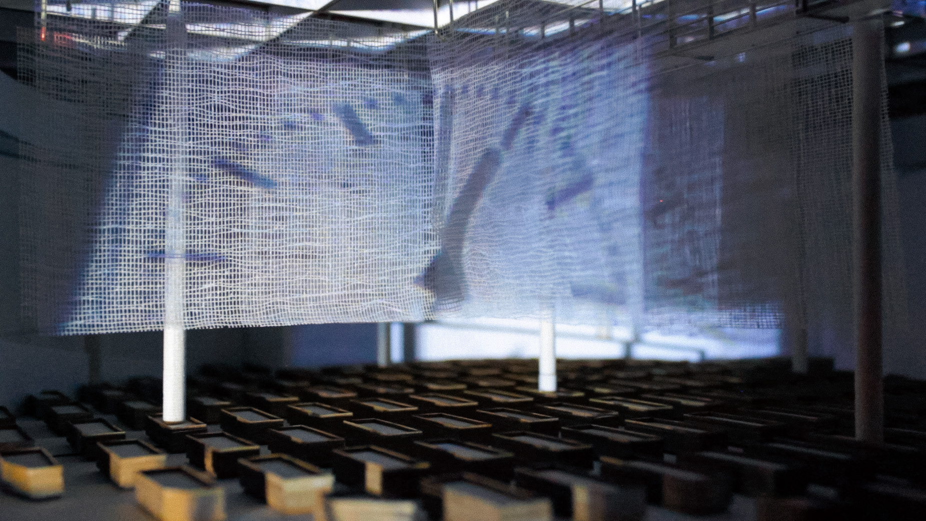
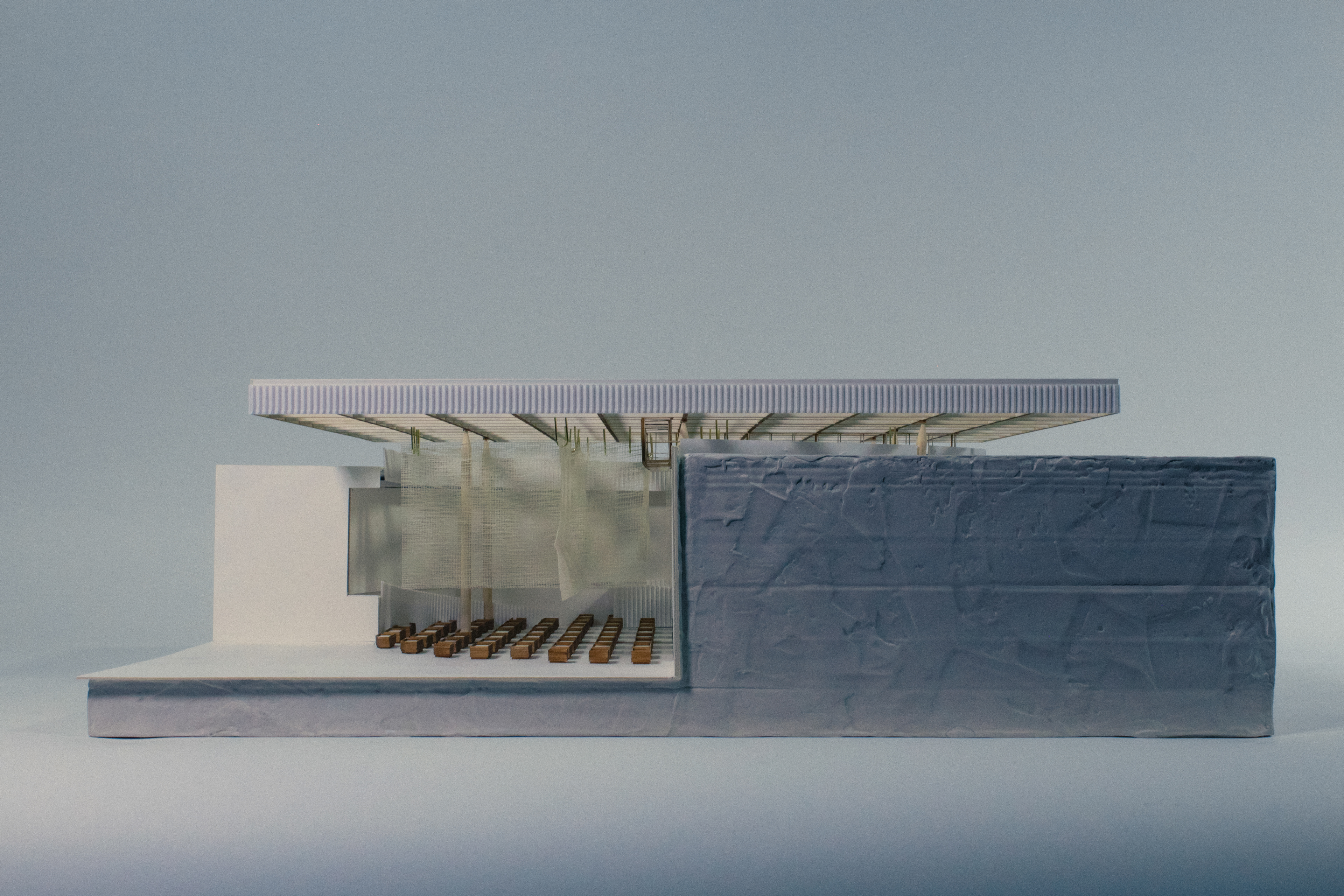
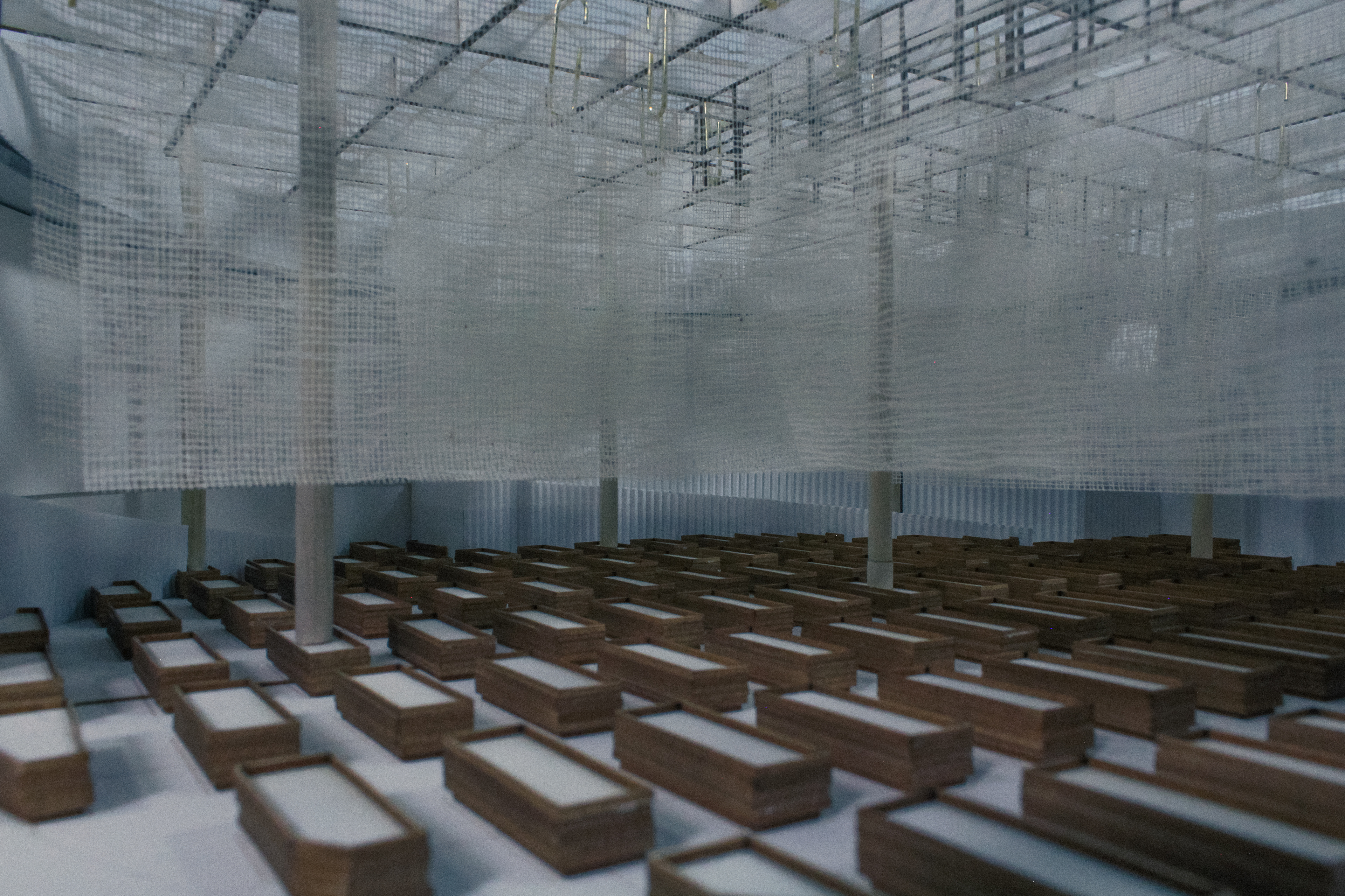
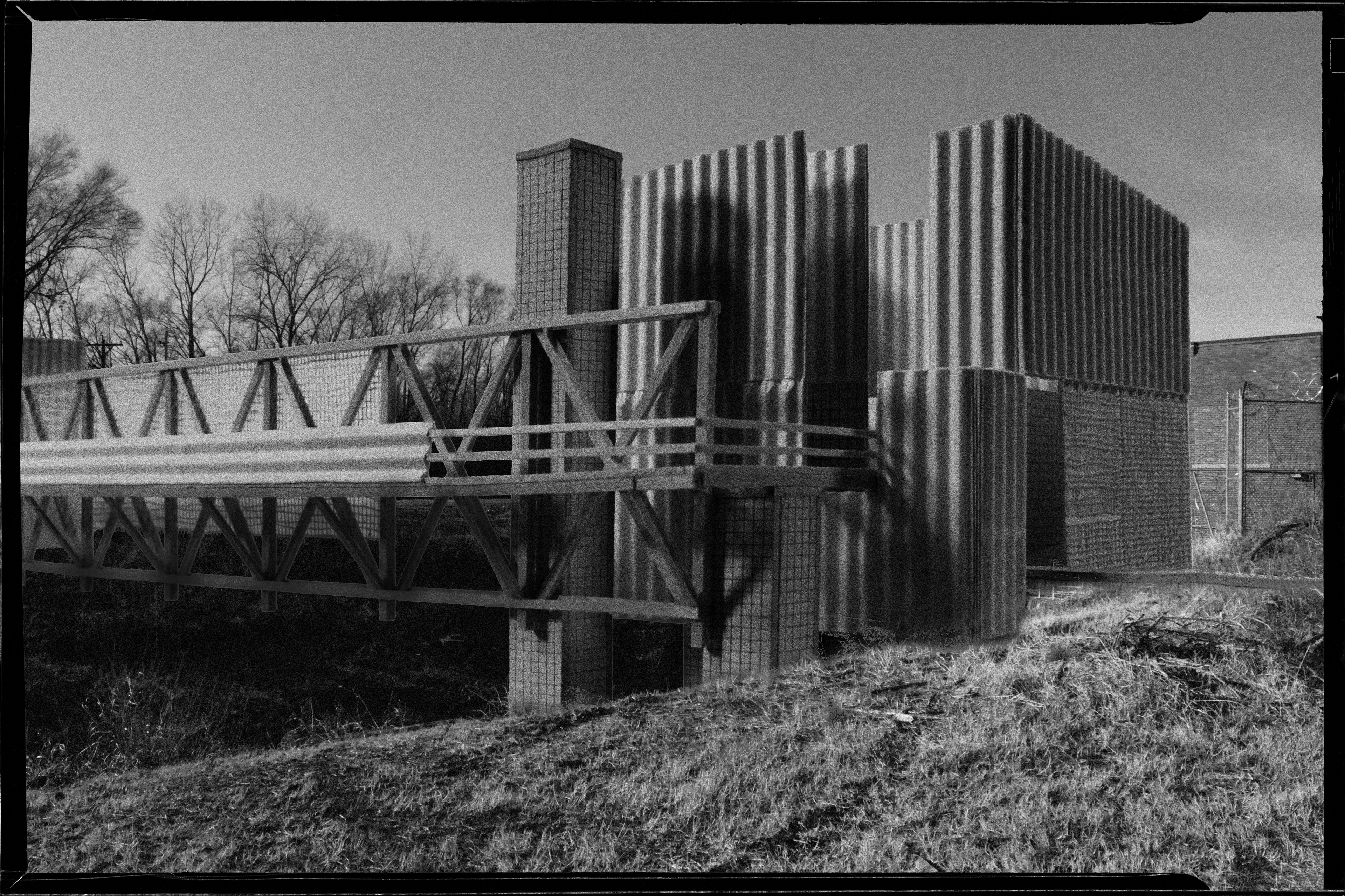
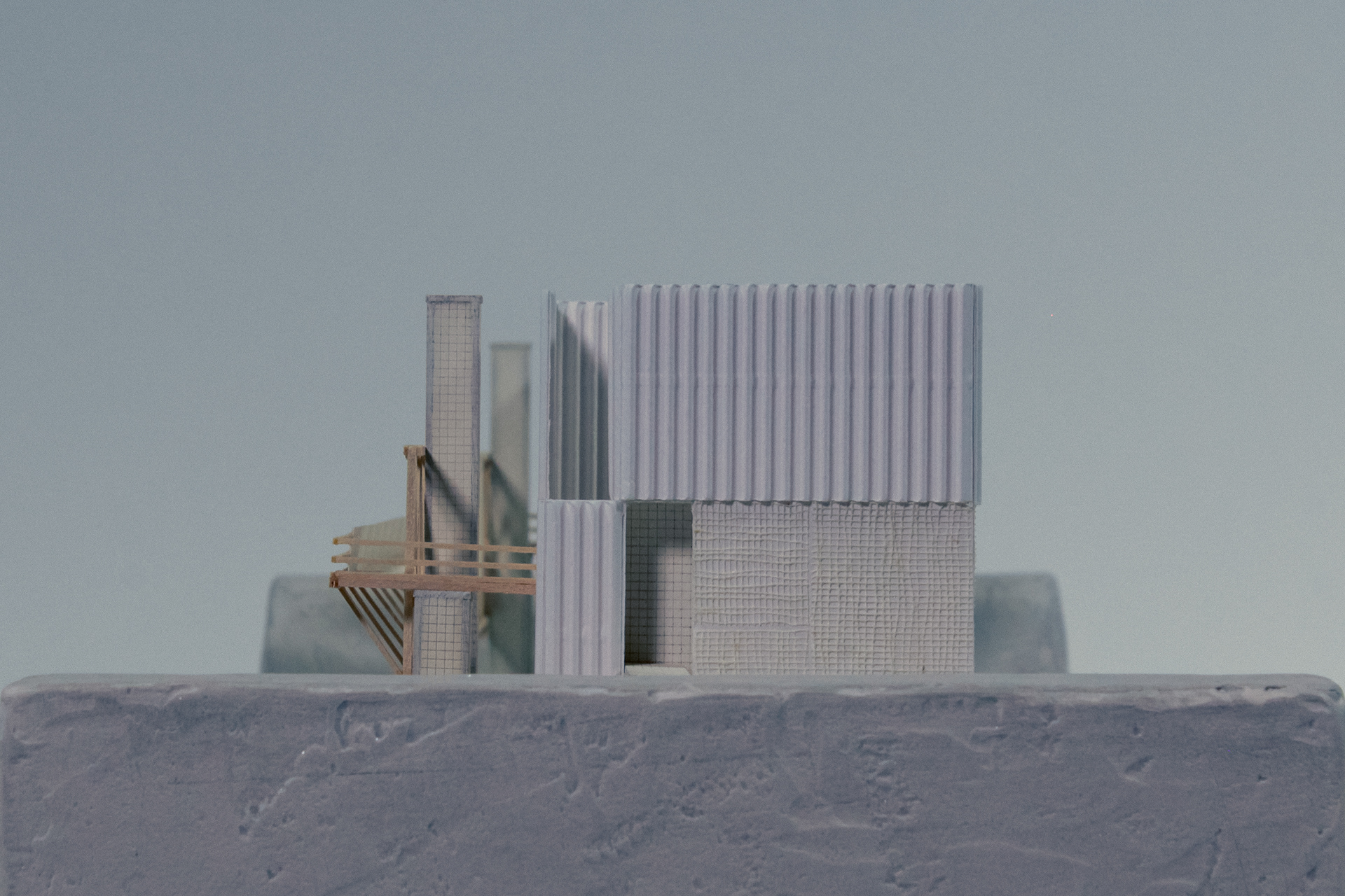
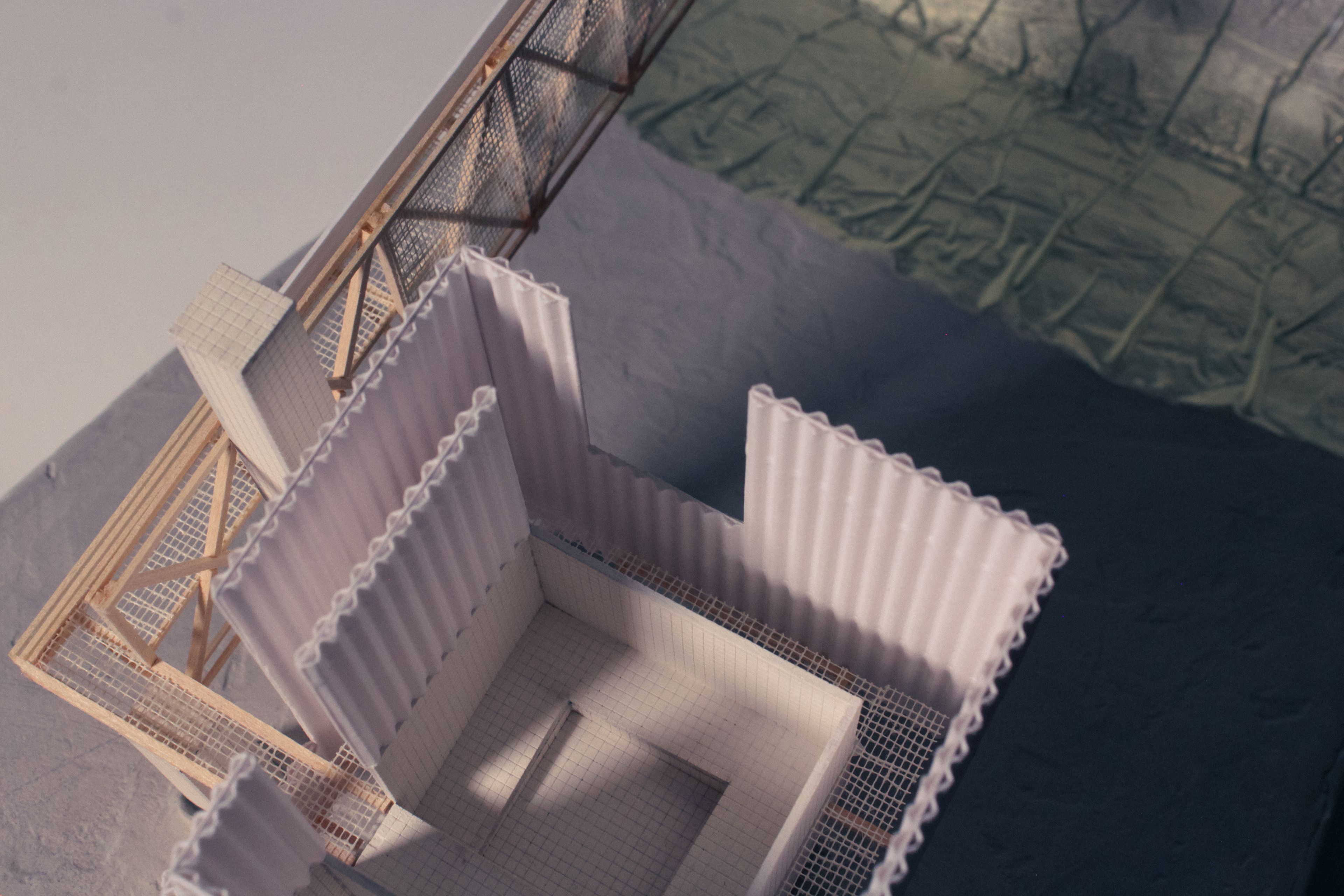
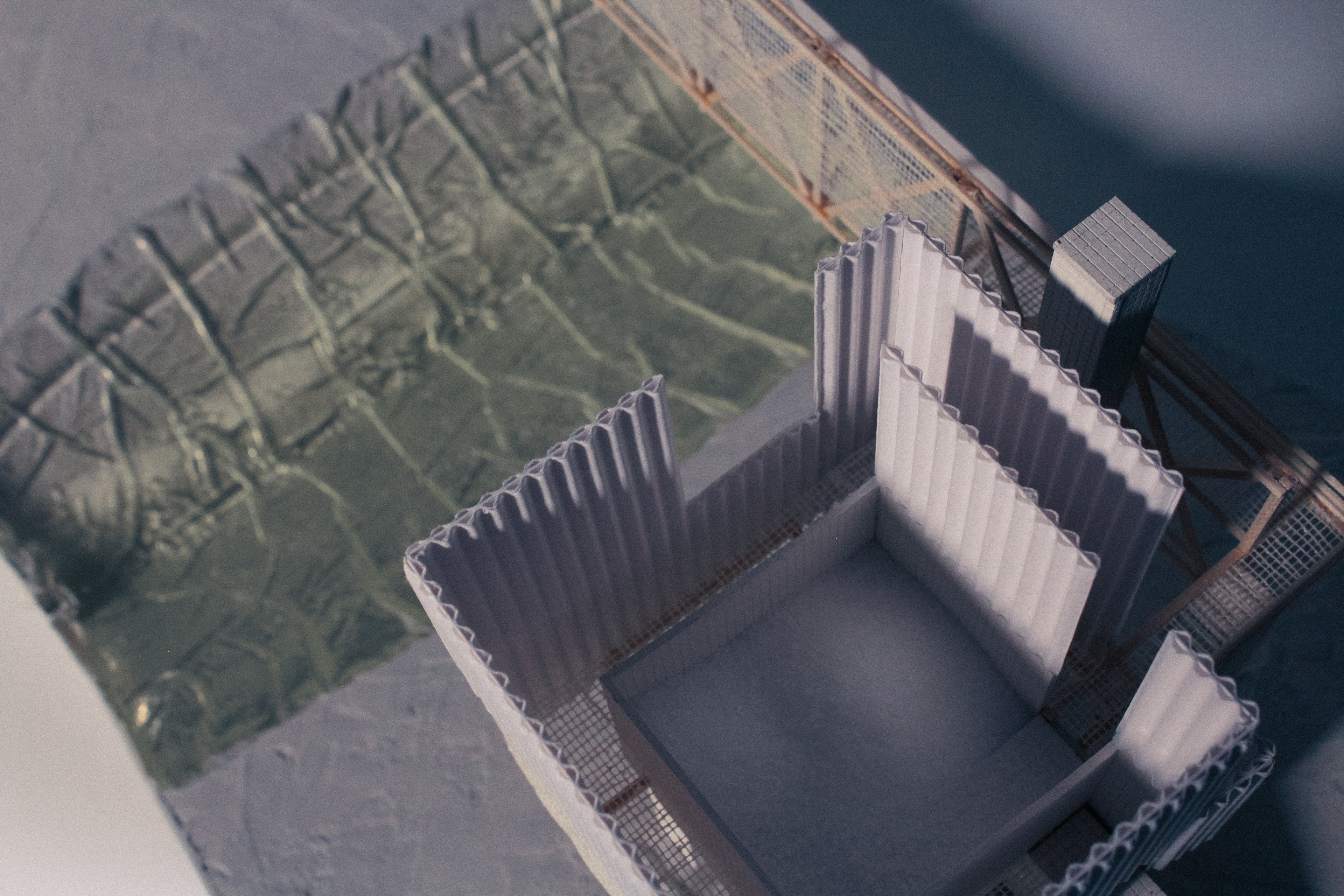
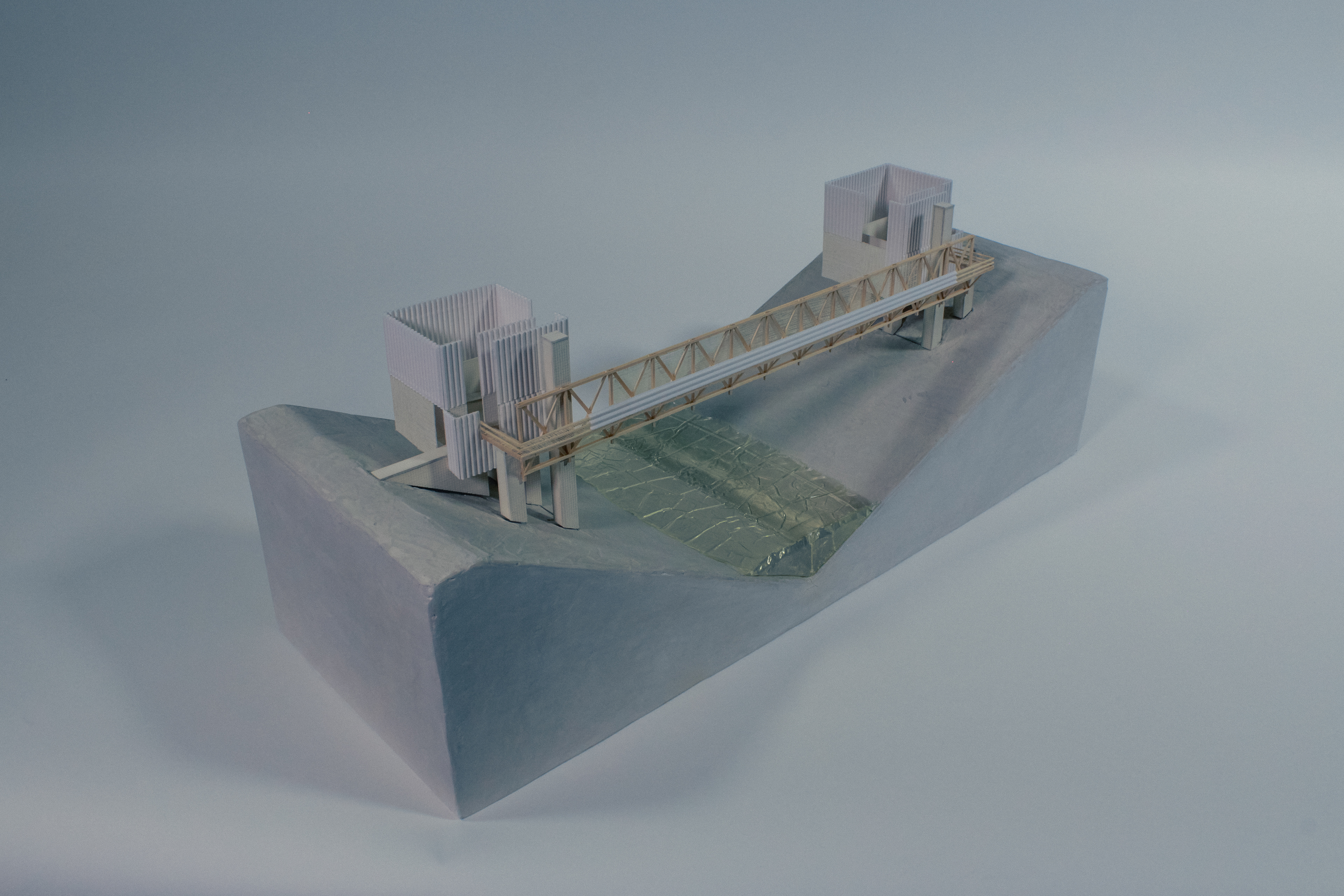
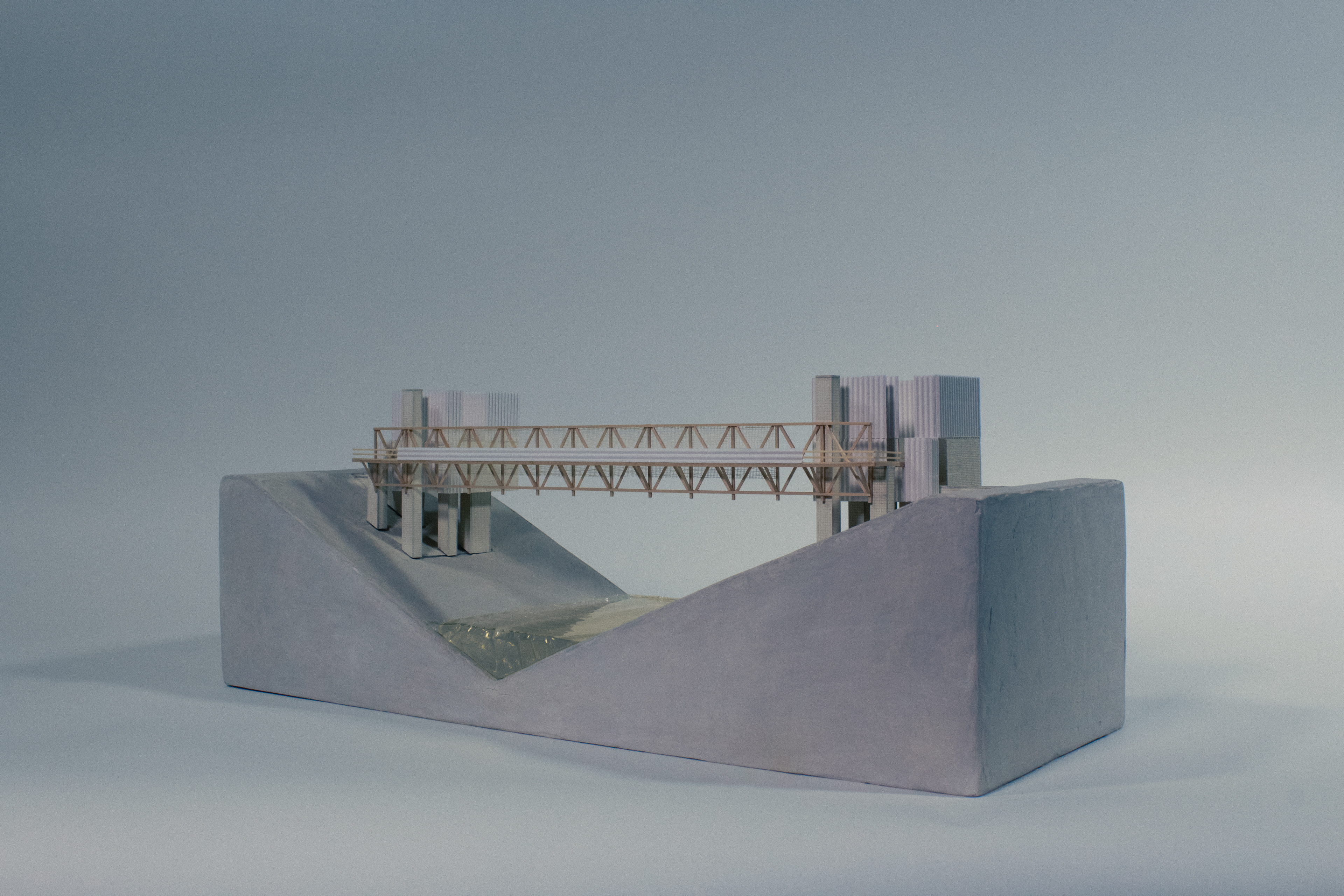
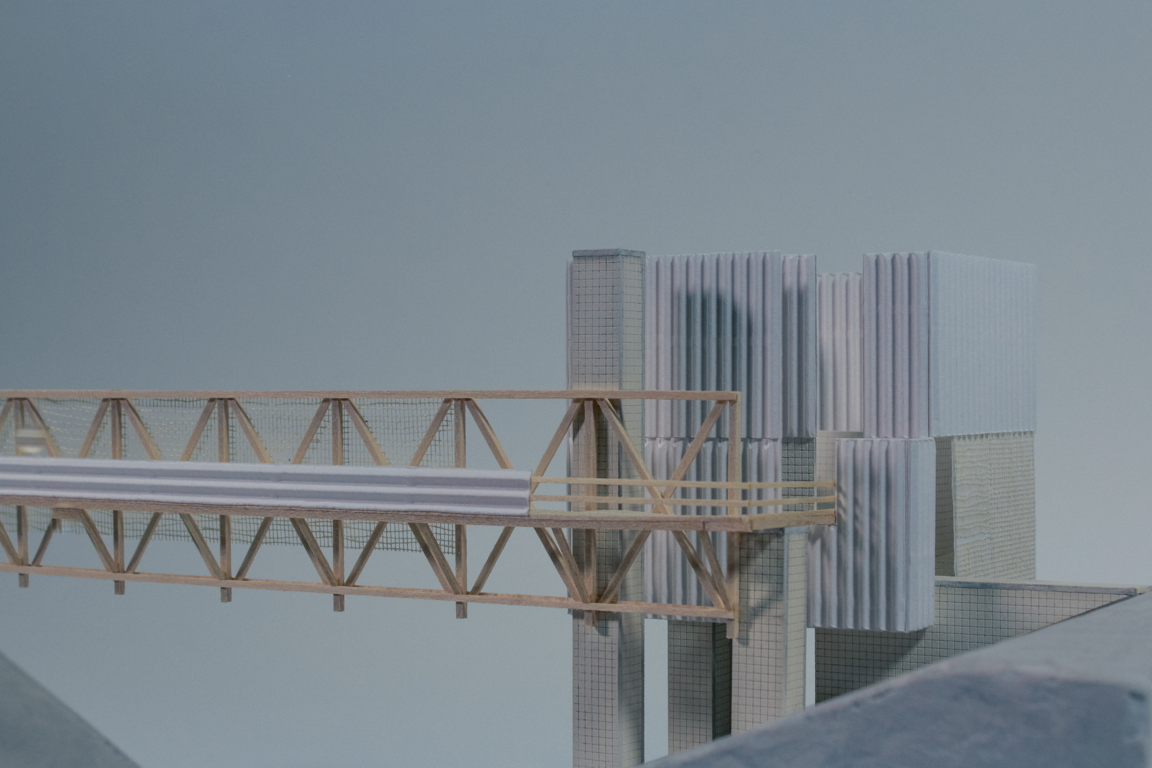
The Passetto—Physical Model [Plaster, Wood, Wire, Paper, Foam, Gauze]
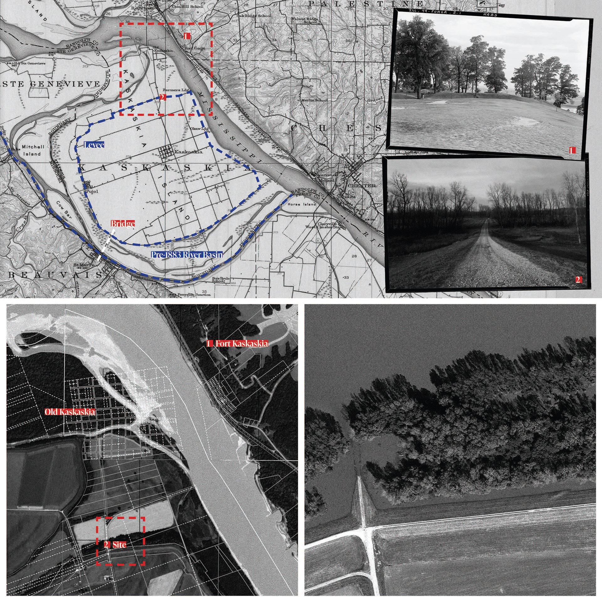
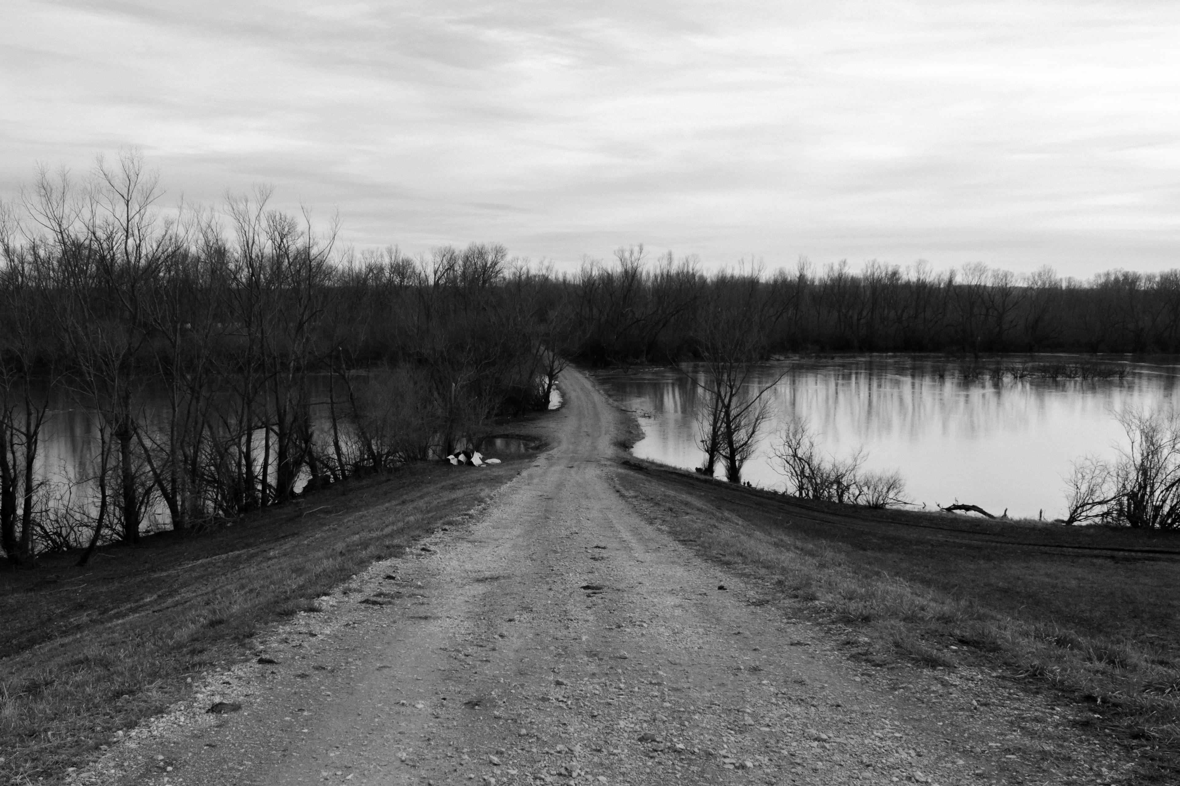
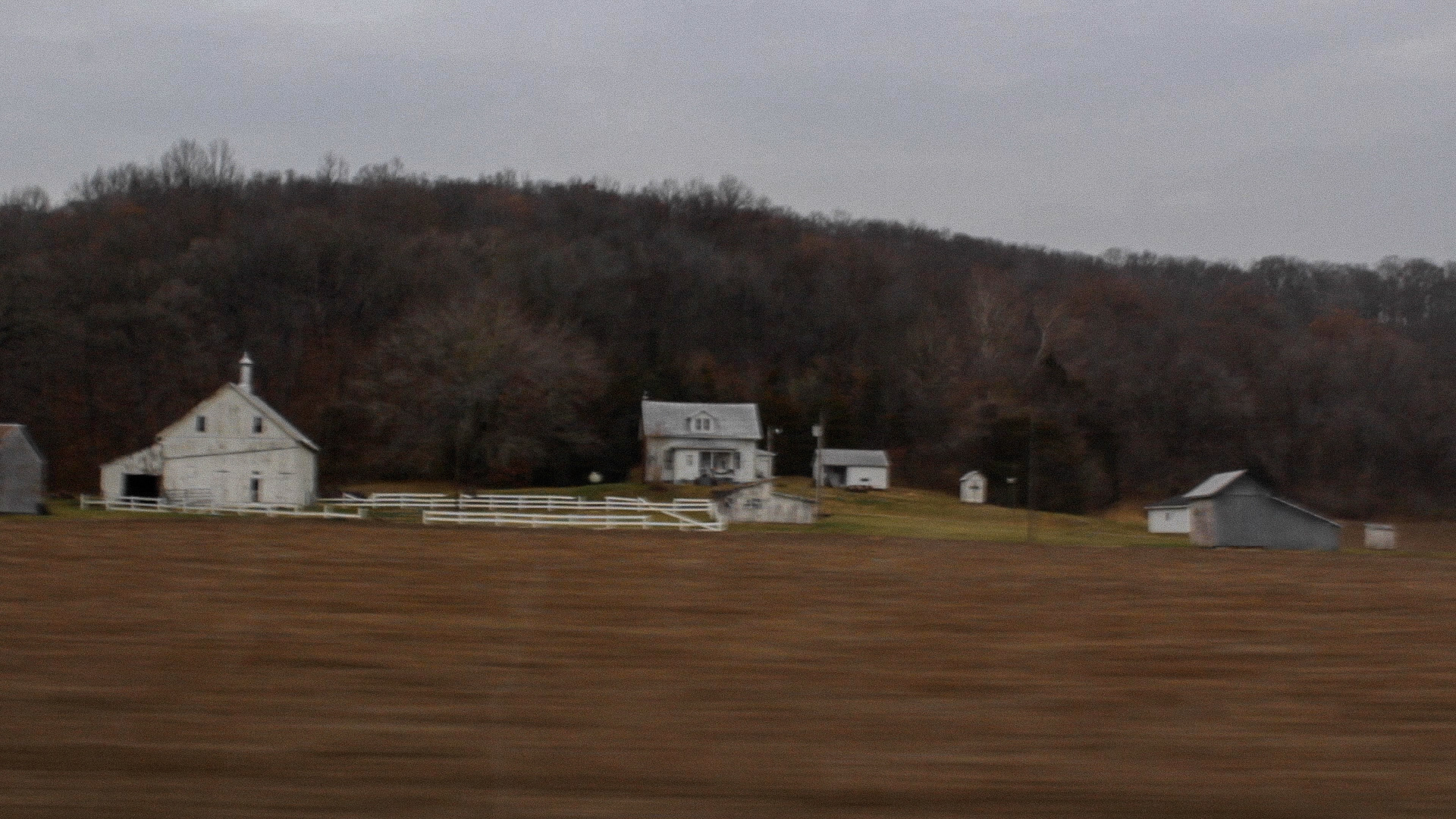
Site Context—Kaskaskia, IL
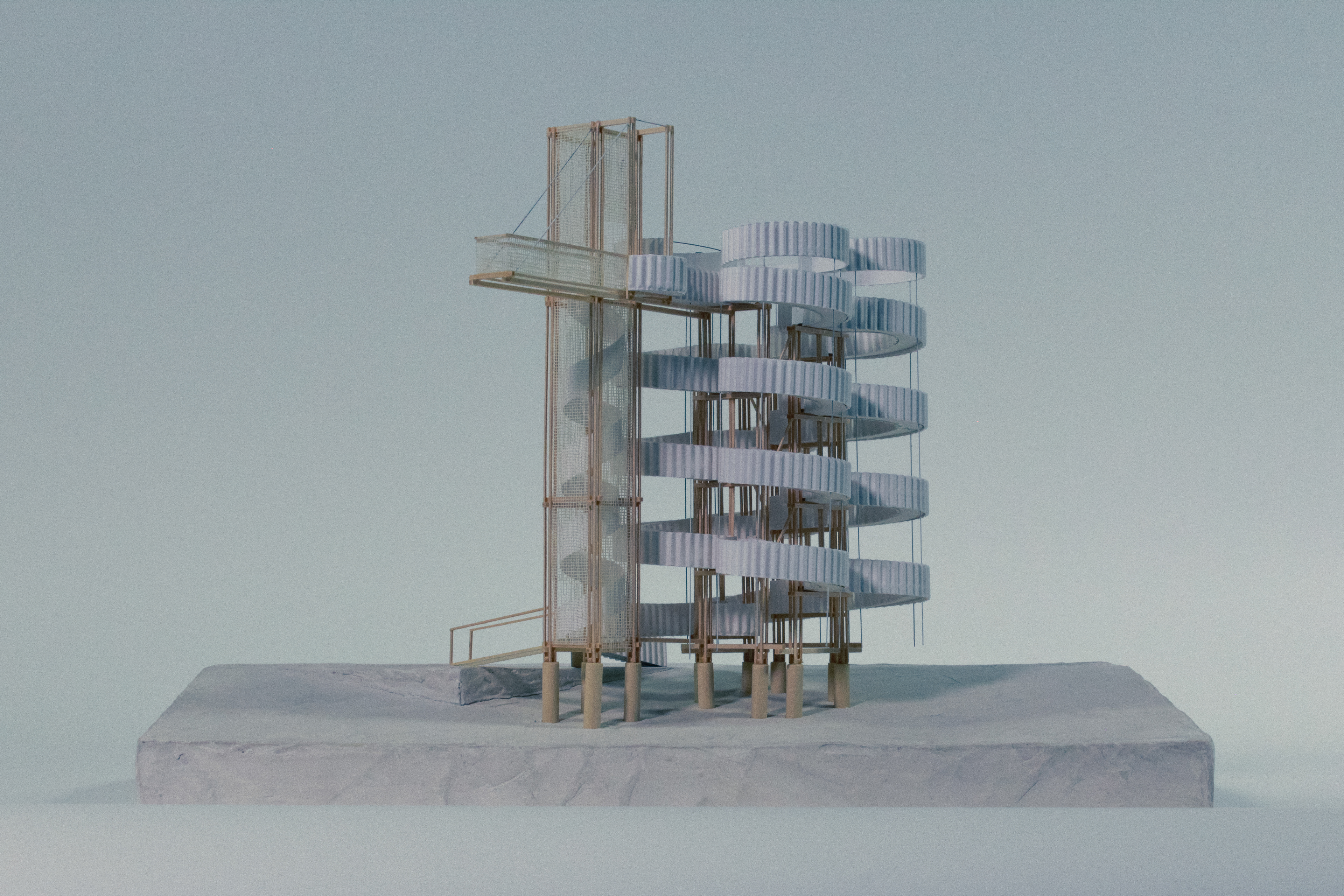
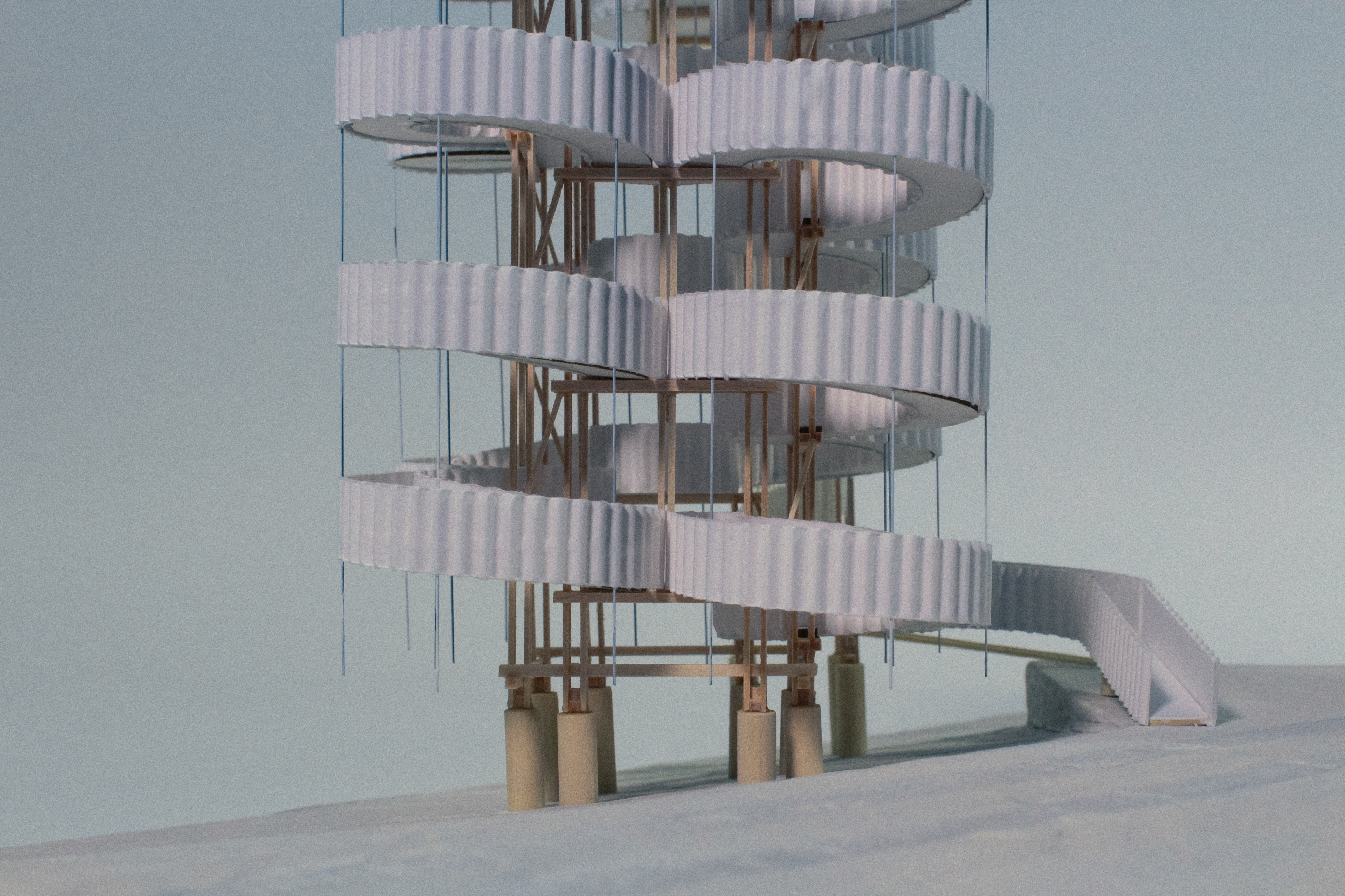
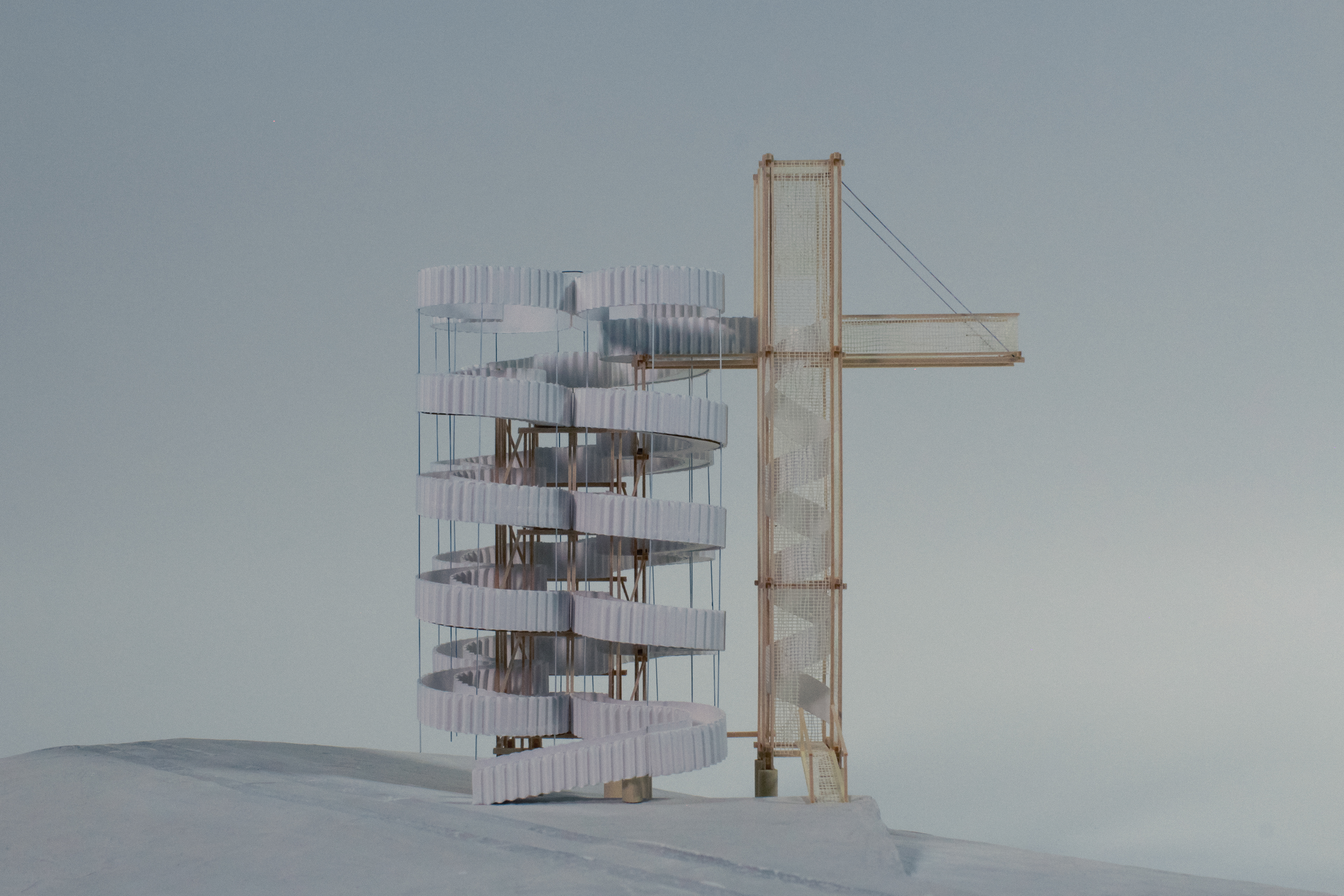
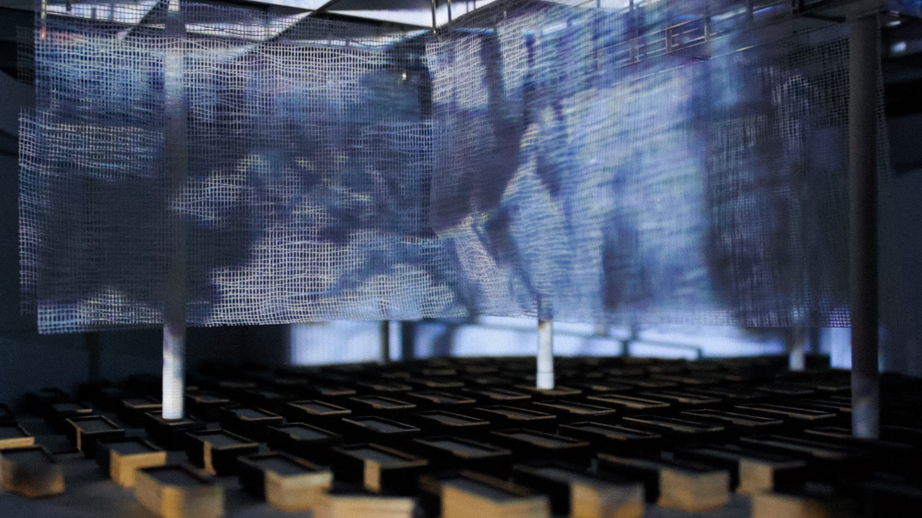
The Passetto—Physical Model [Plaster, Wood, Wire, Paper, Foam, Gauze]
Tracing Le Chemin du Rois
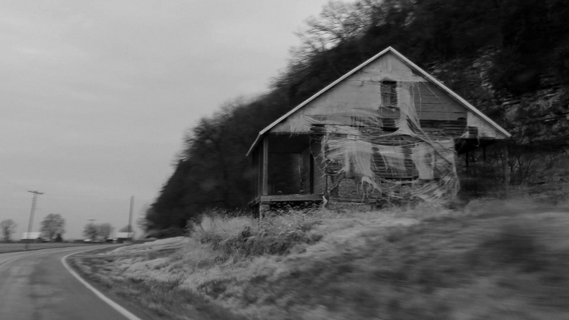
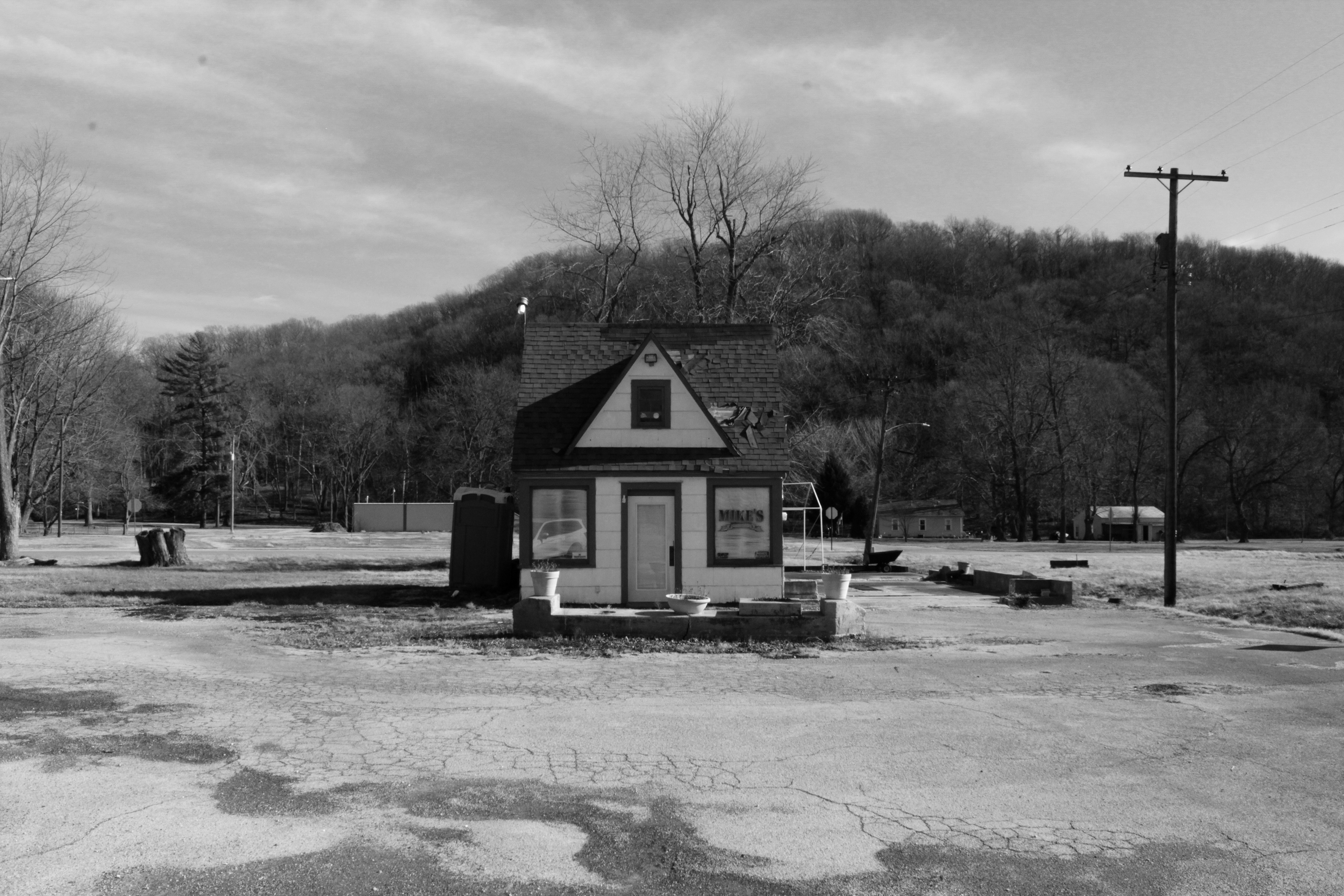
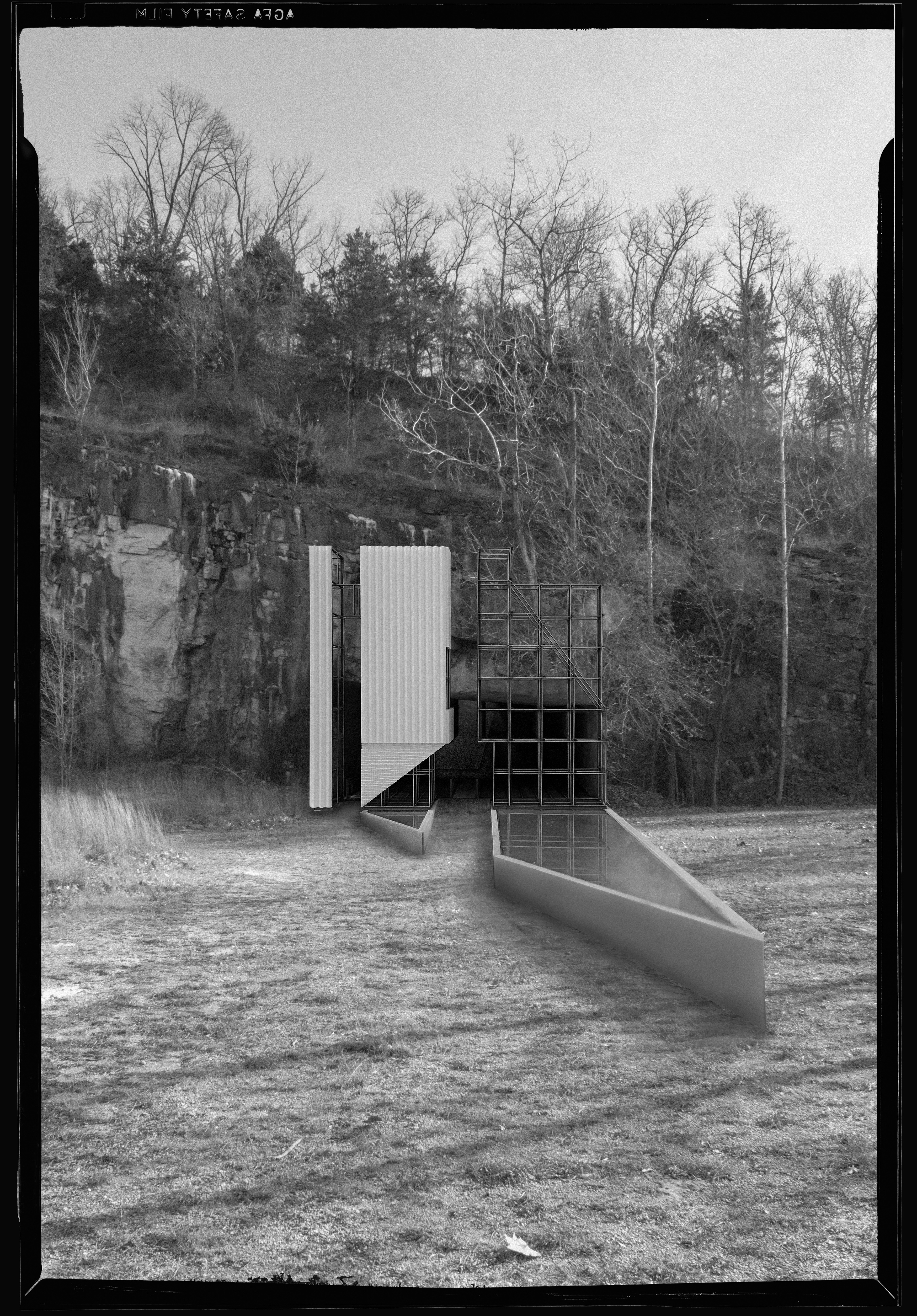
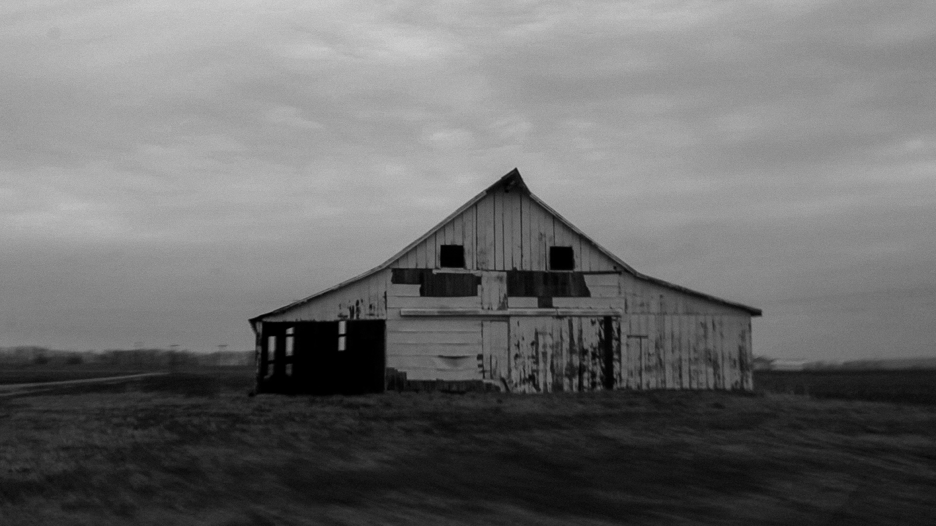
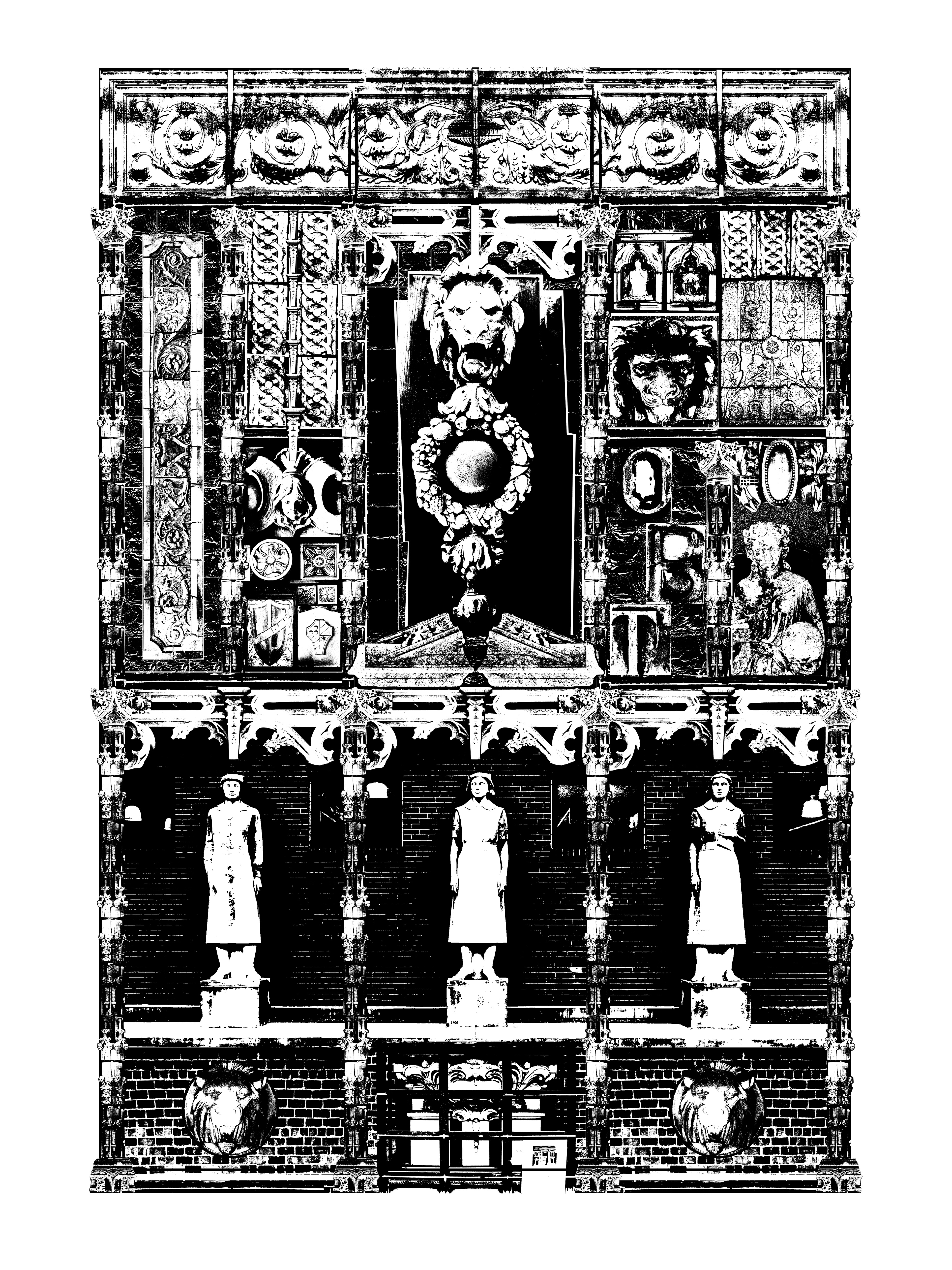
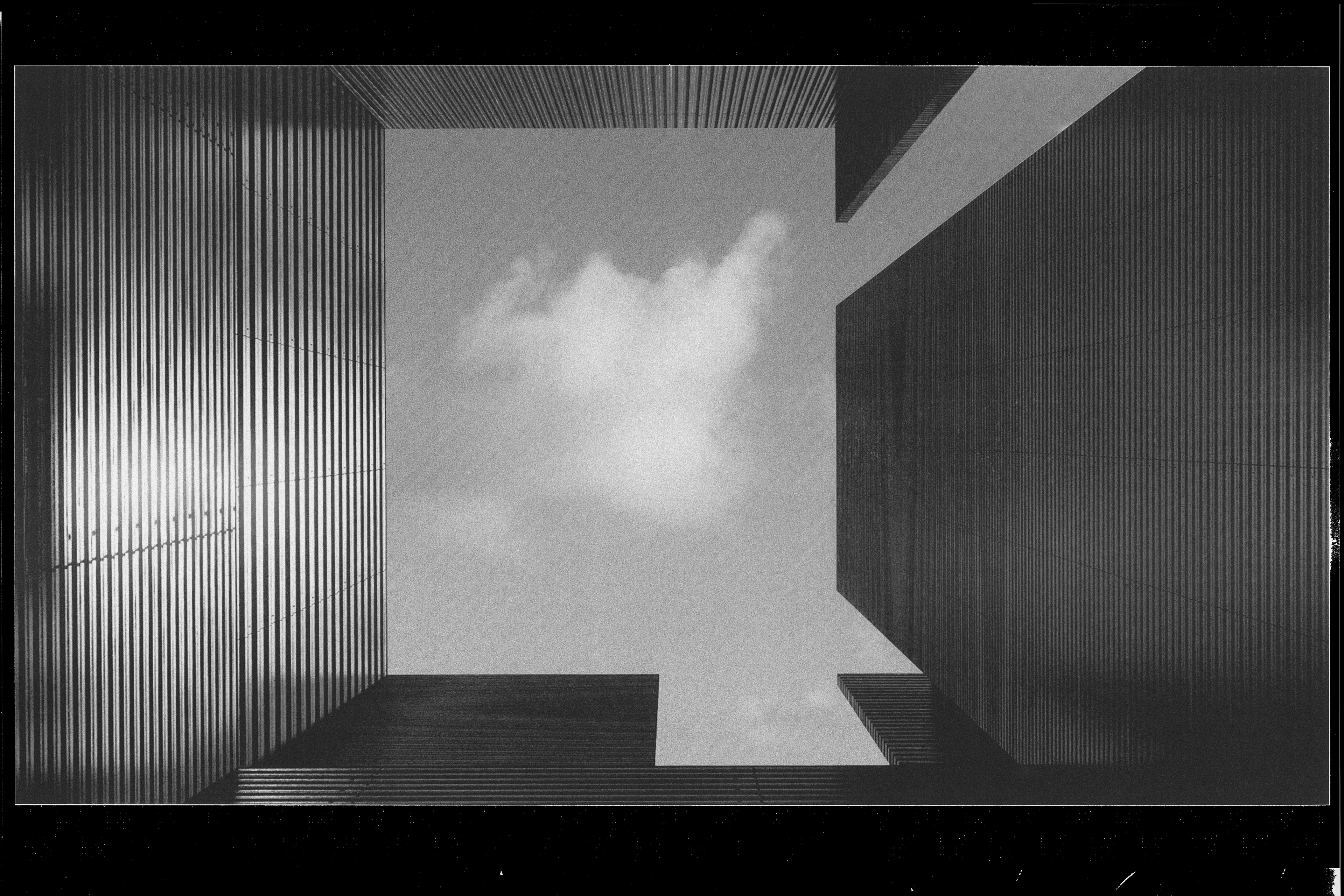
Approaching the Chapel—Old Valmeyer, IL
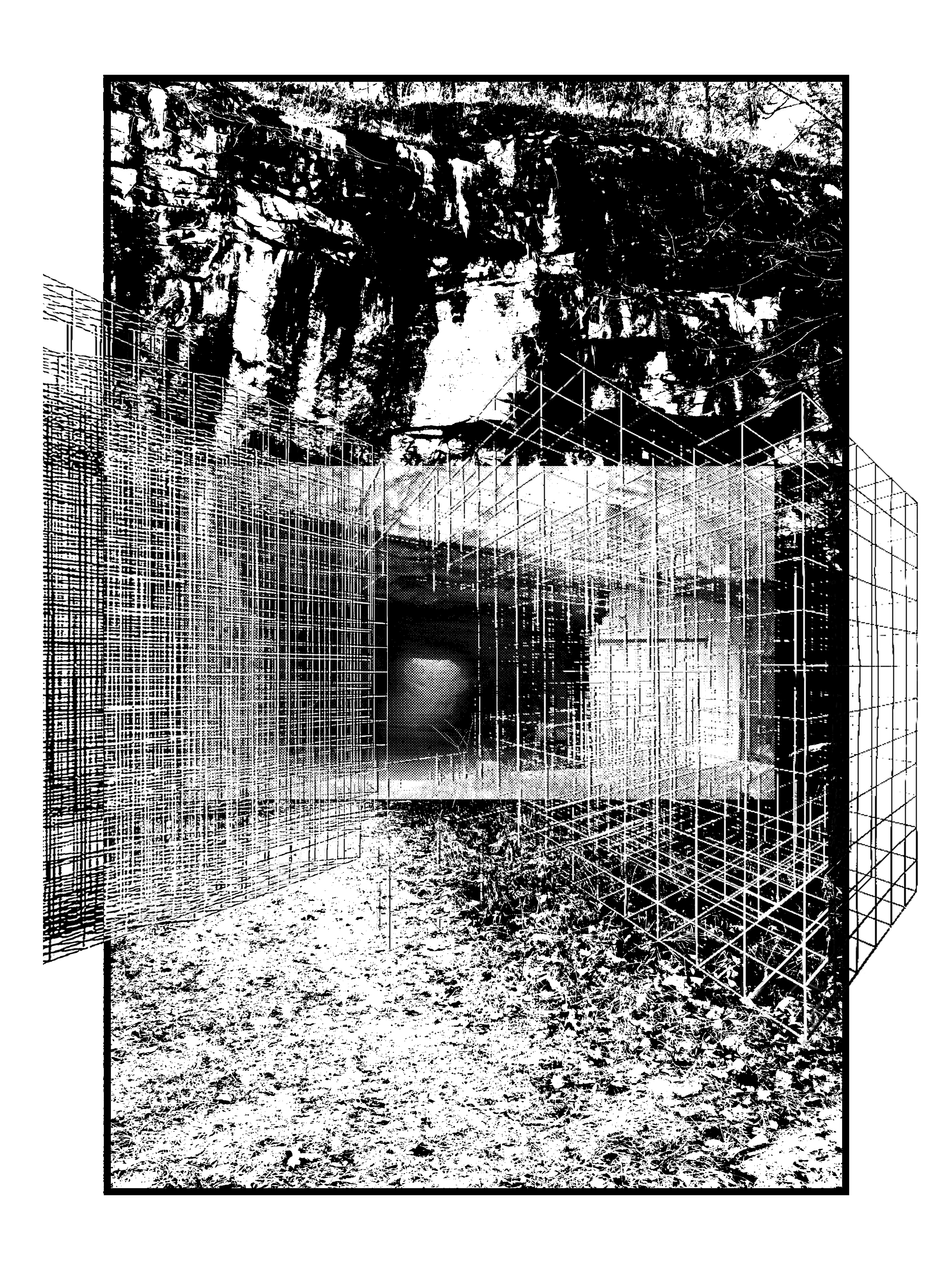
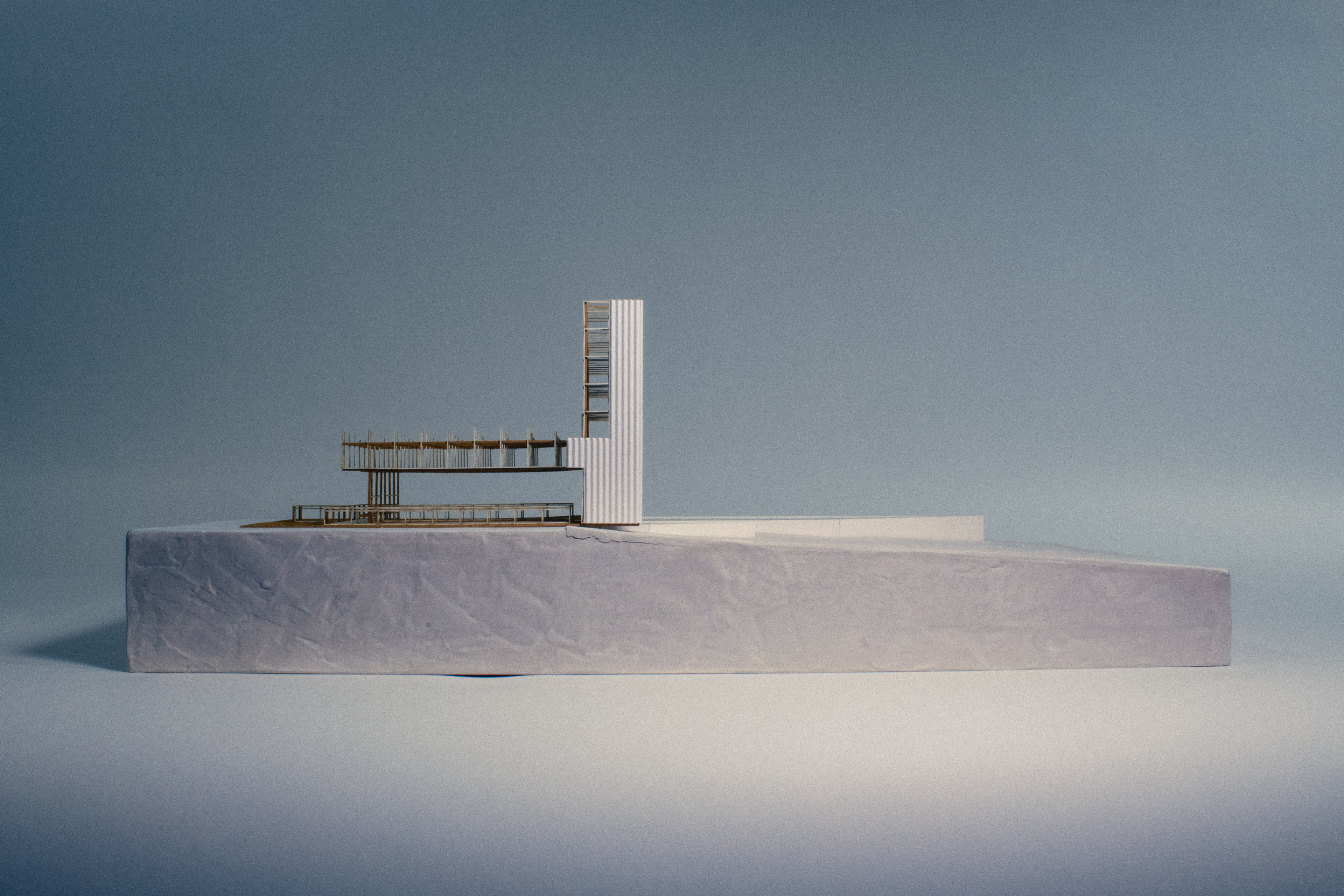
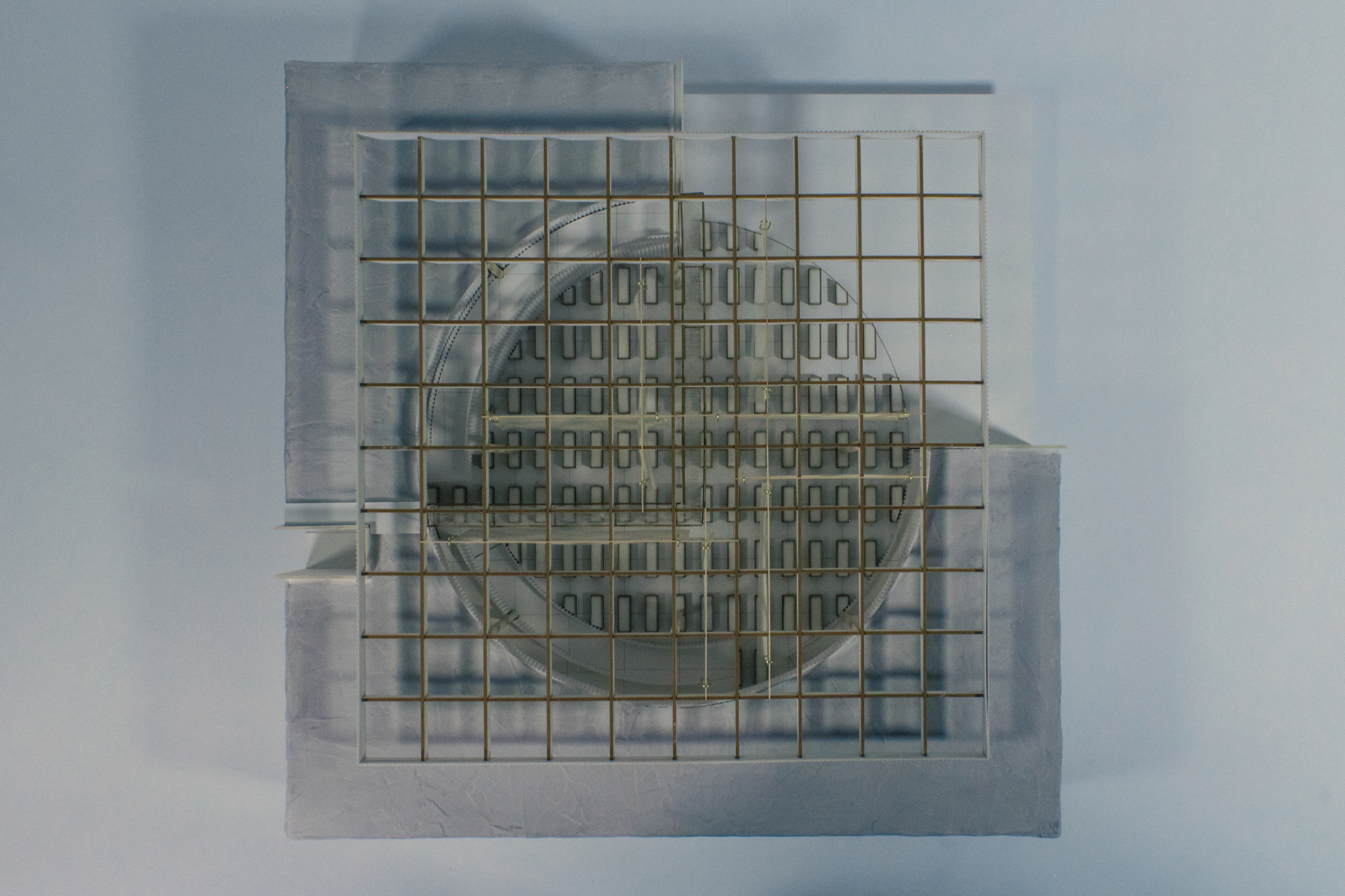
The Chapel—Physical Model [Plaster, Wood, Wire, Paper, Foam, Gauze]
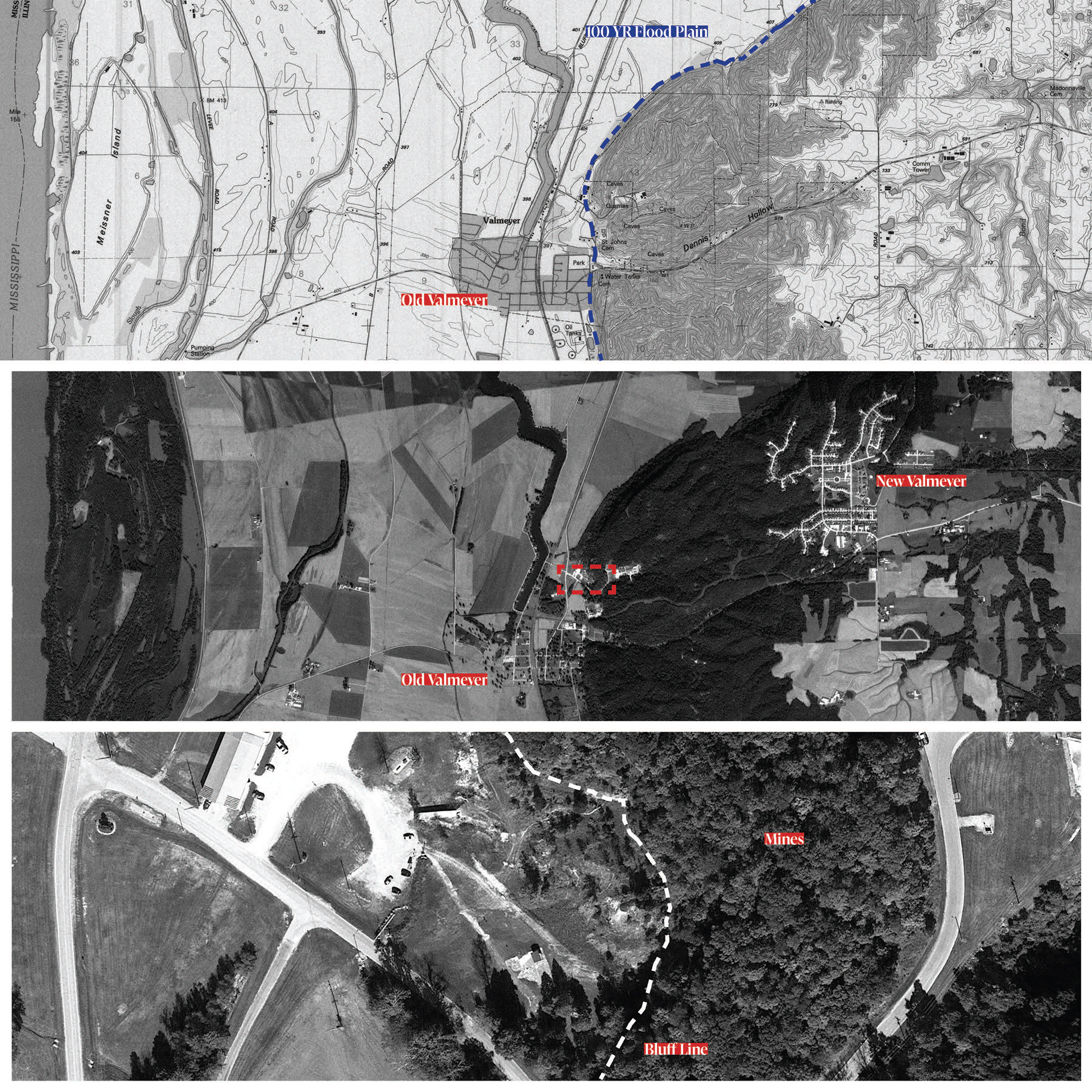
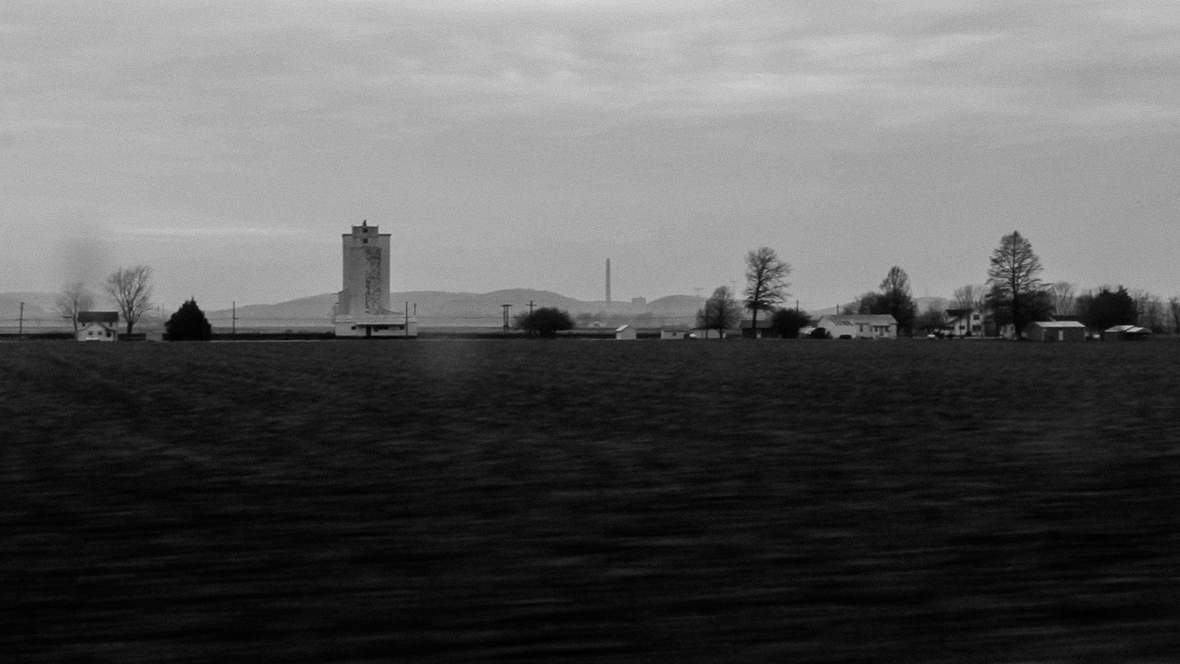
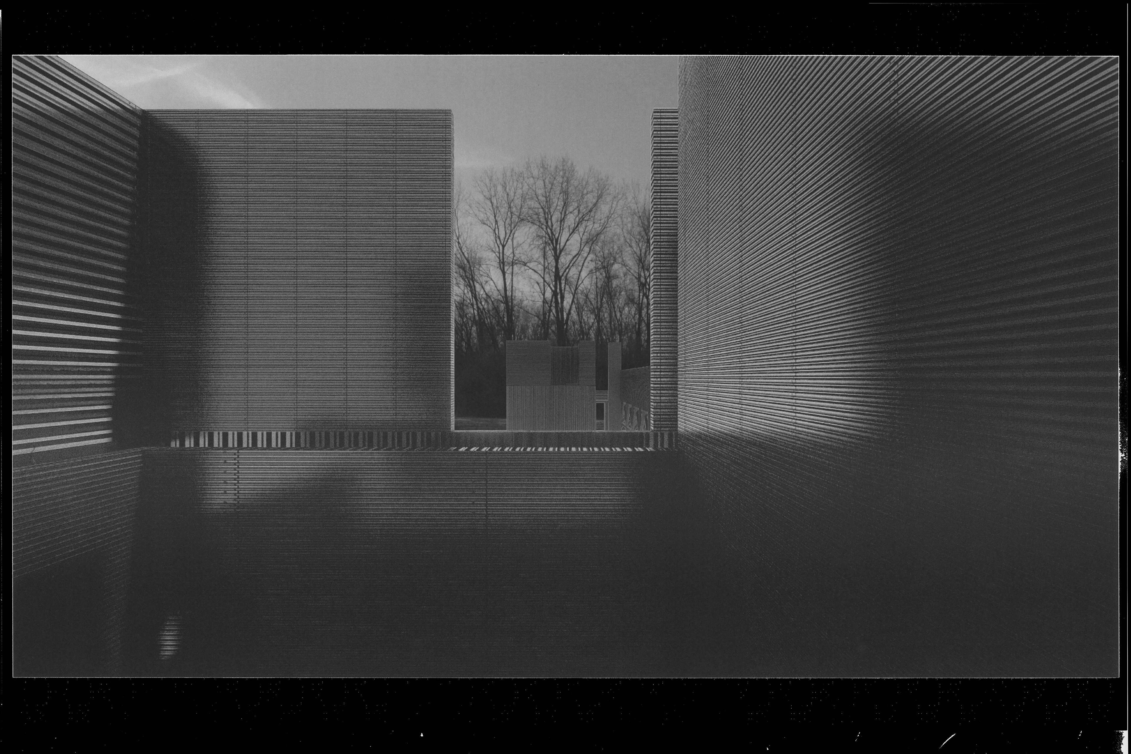
Site Context—Old Valmeyer, IL
The Chapel—Physical Model [Plaster, Wood, Wire, Paper, Foam, Gauze]
Tracing Le Chemin du Rois
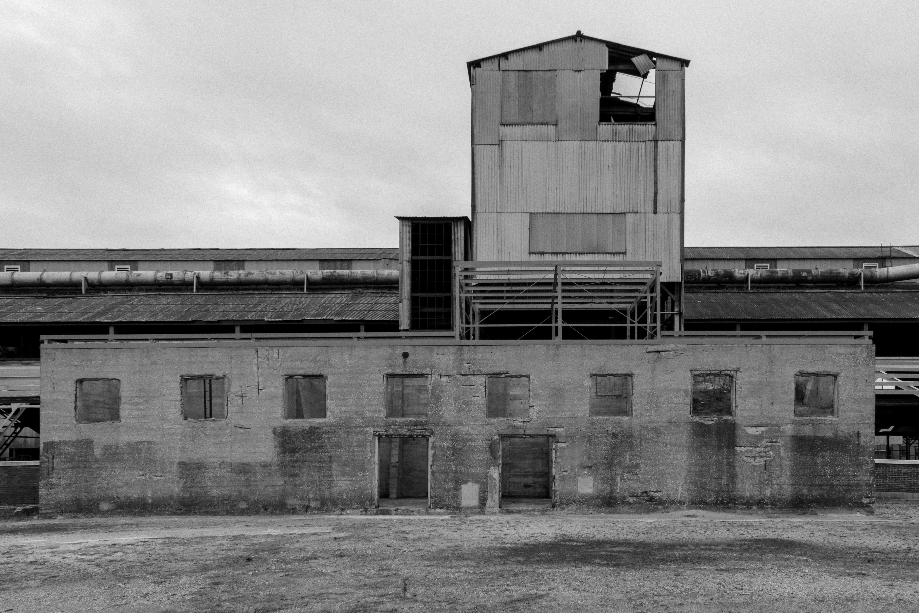
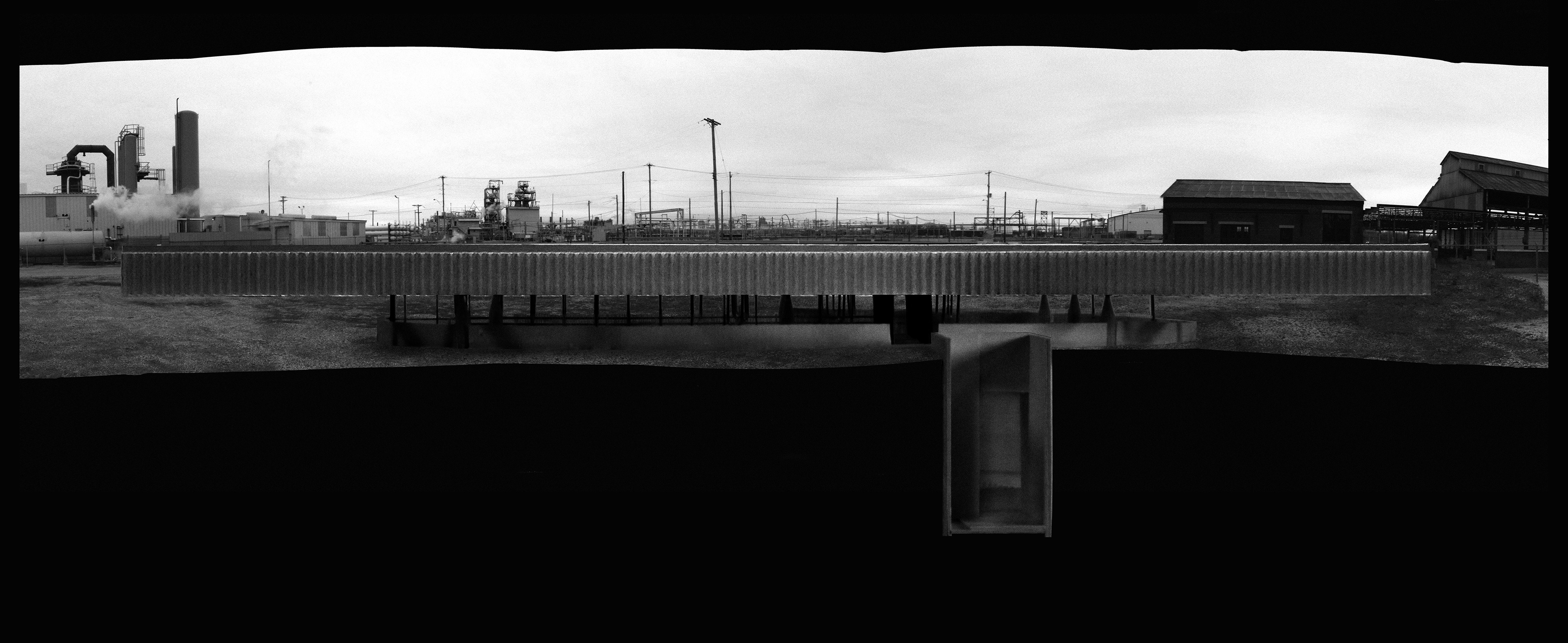
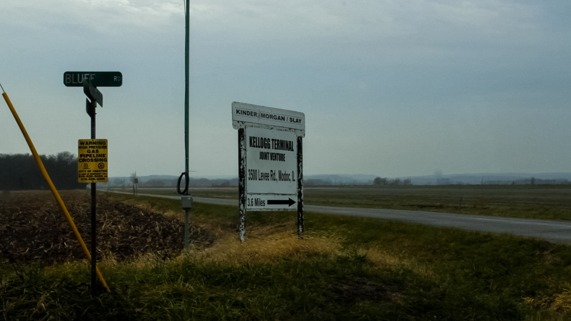
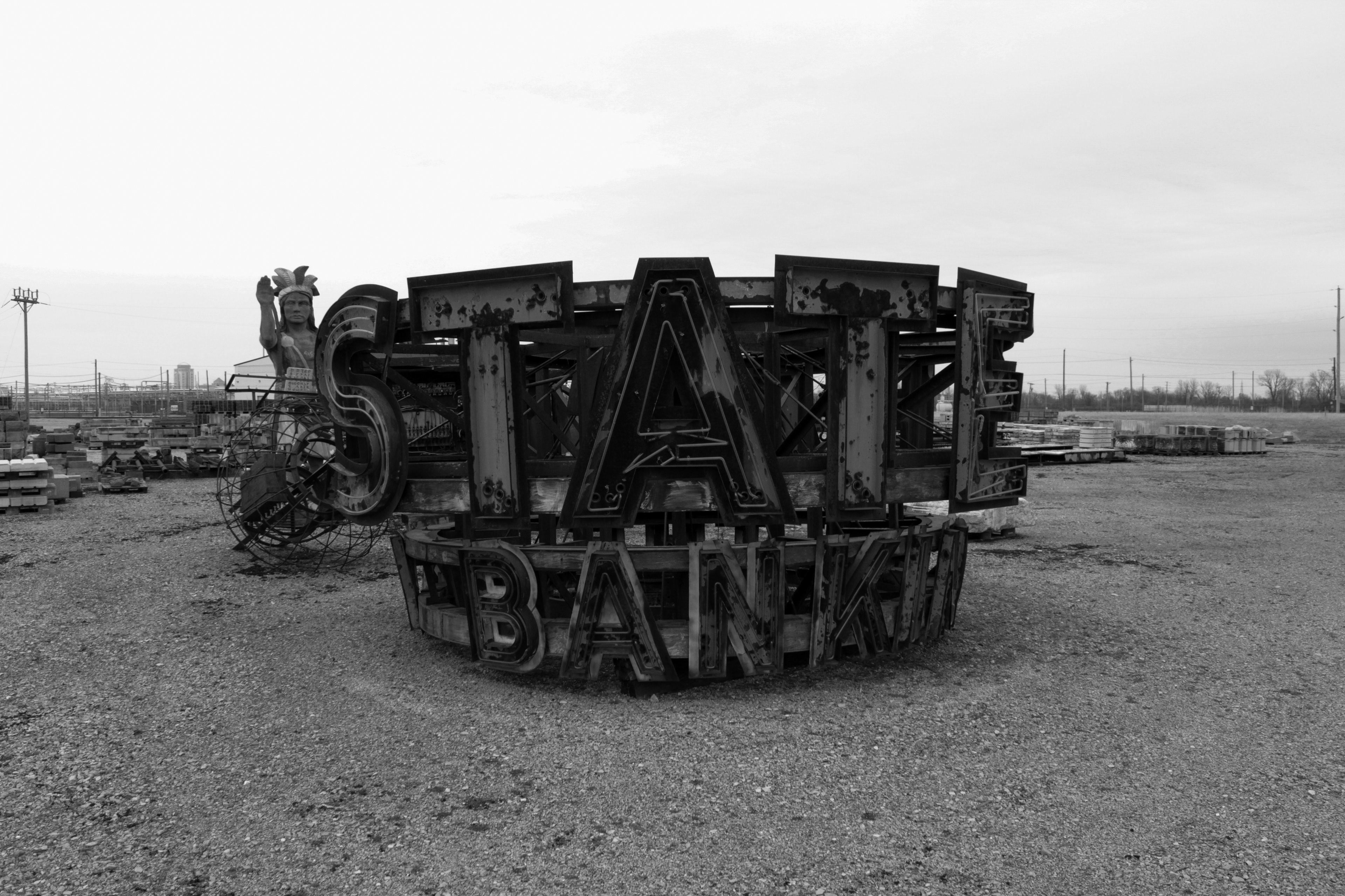
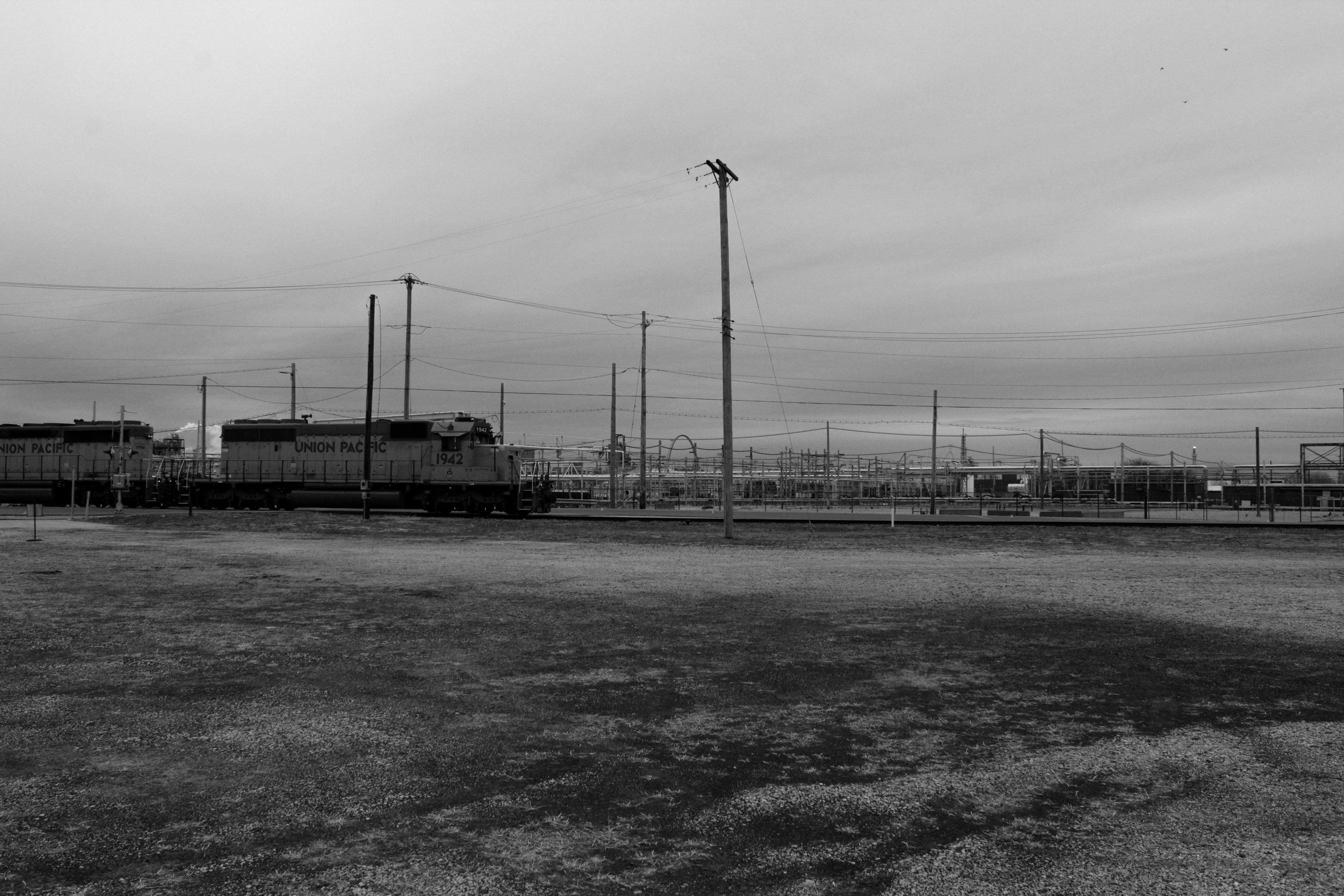
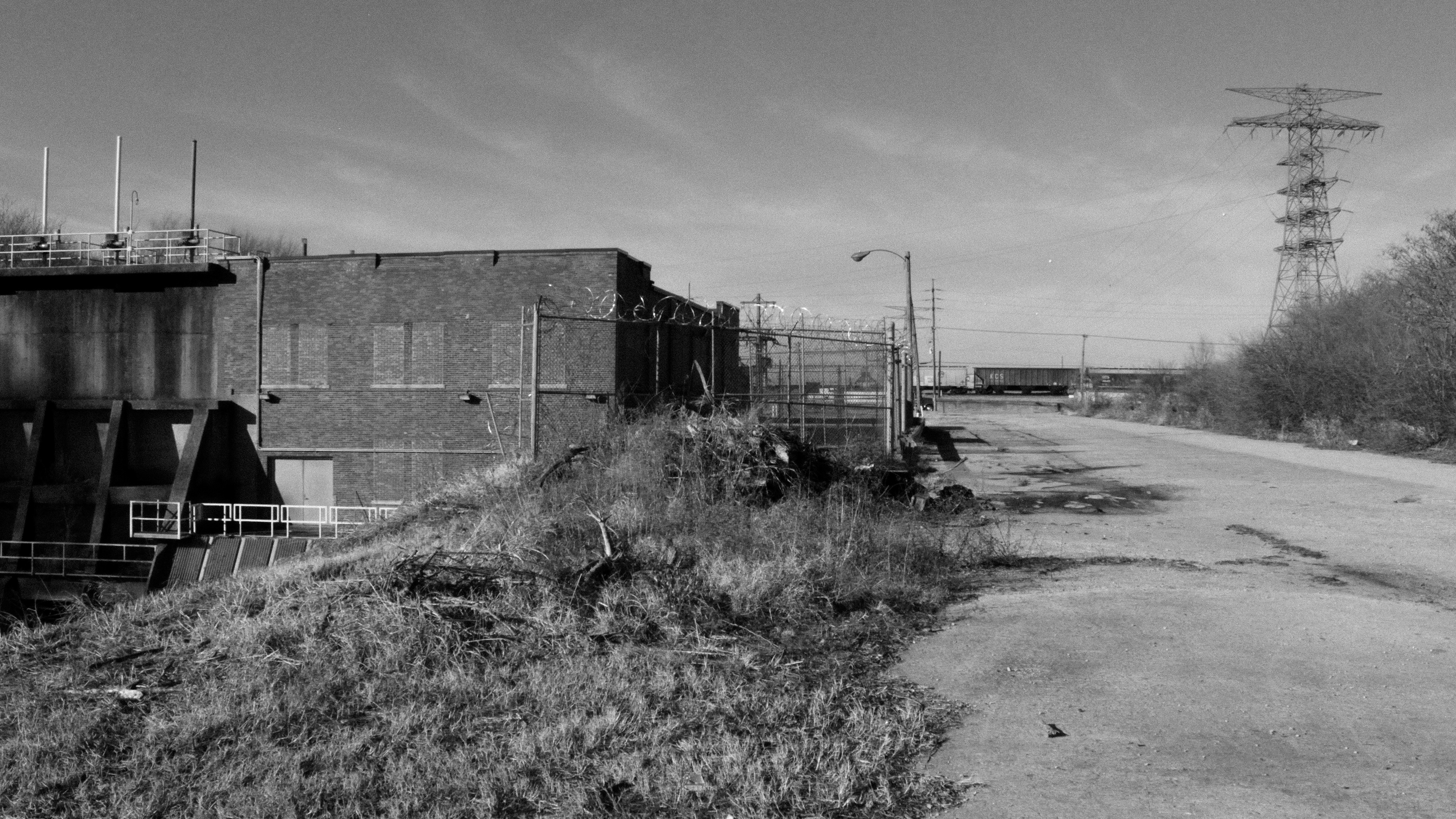
Approaching the Monument—Sterling Steel Foundry, Sauget, IL
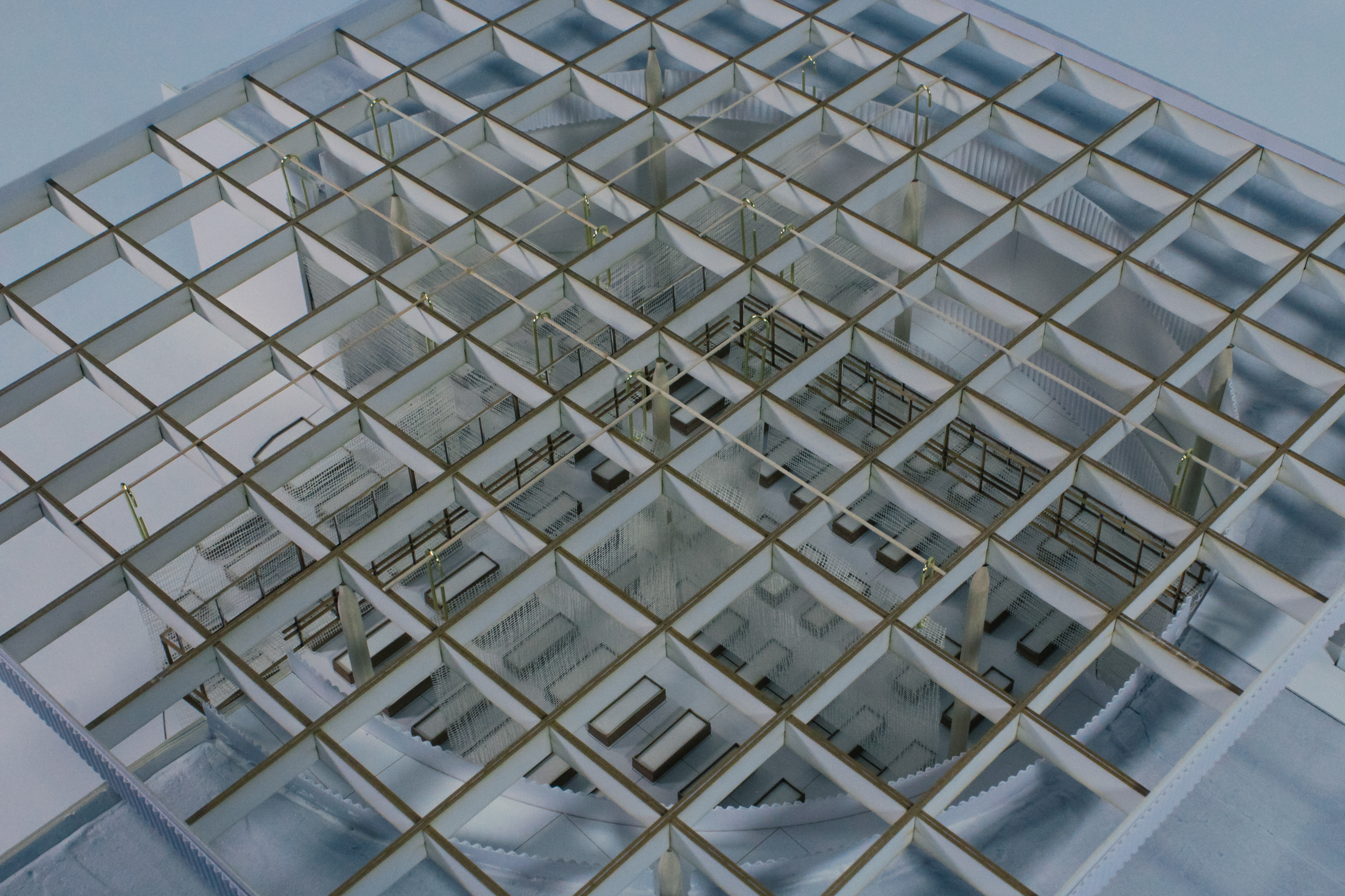
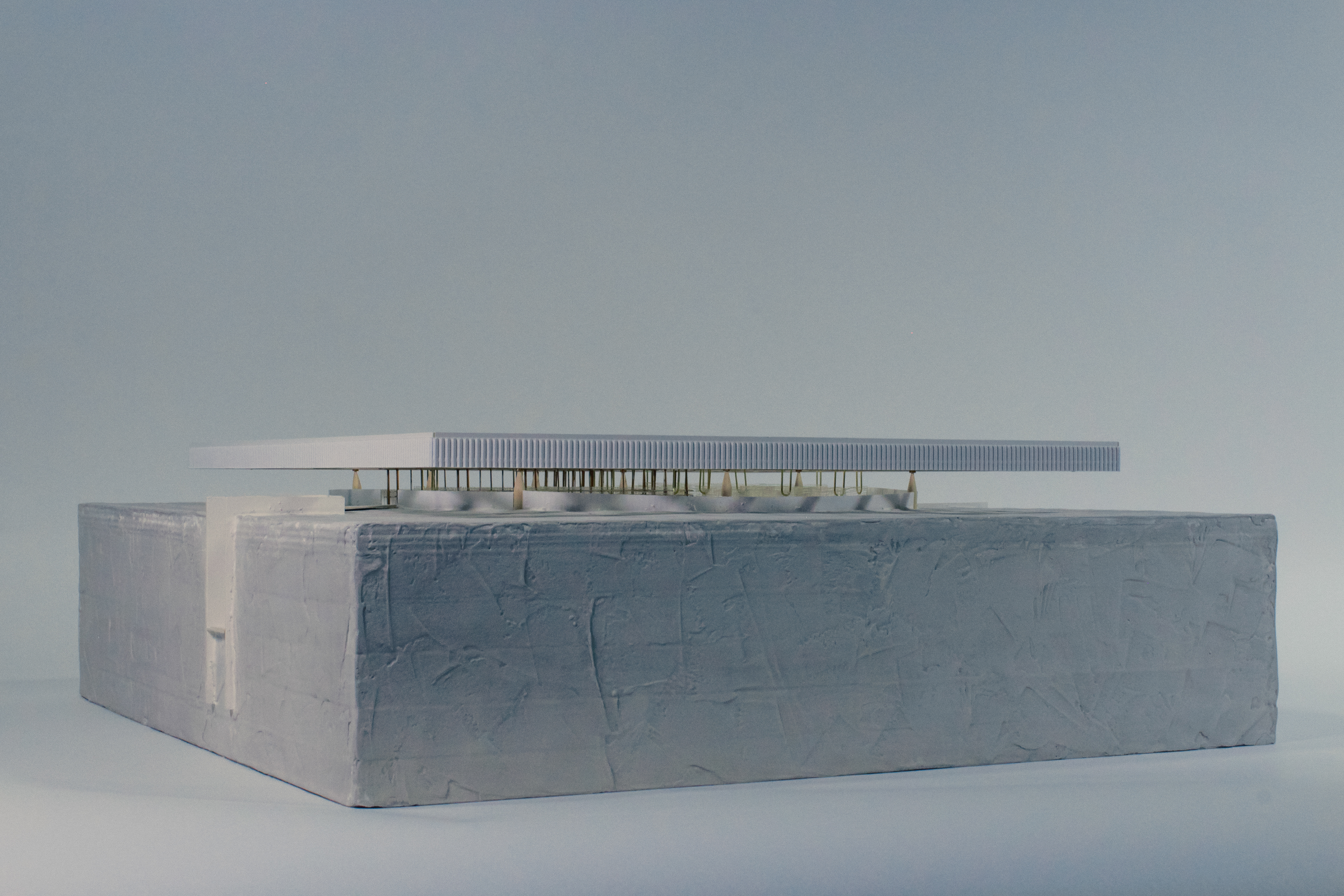
The Monument—Physical Model [Plaster, Wood, Wire, Paper, Foam, Gauze]
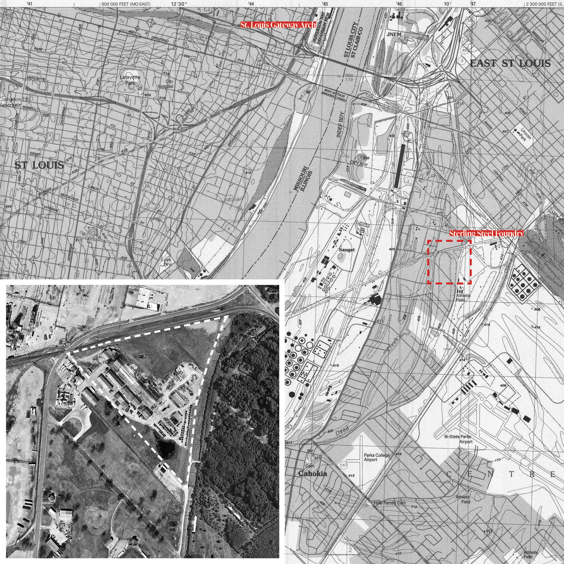
Site Context—Sauget, IL
Tracing Le Chemin du Rois

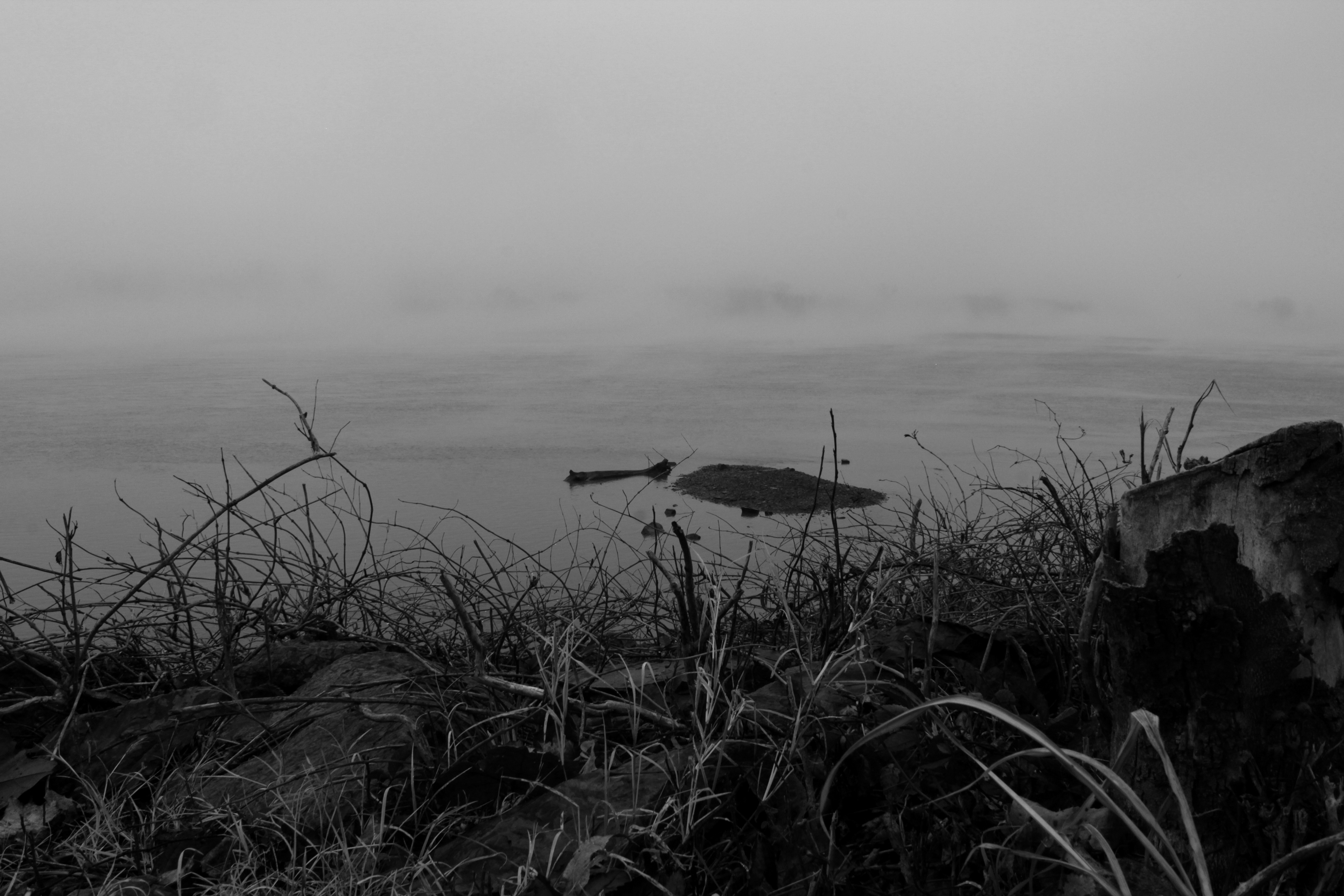
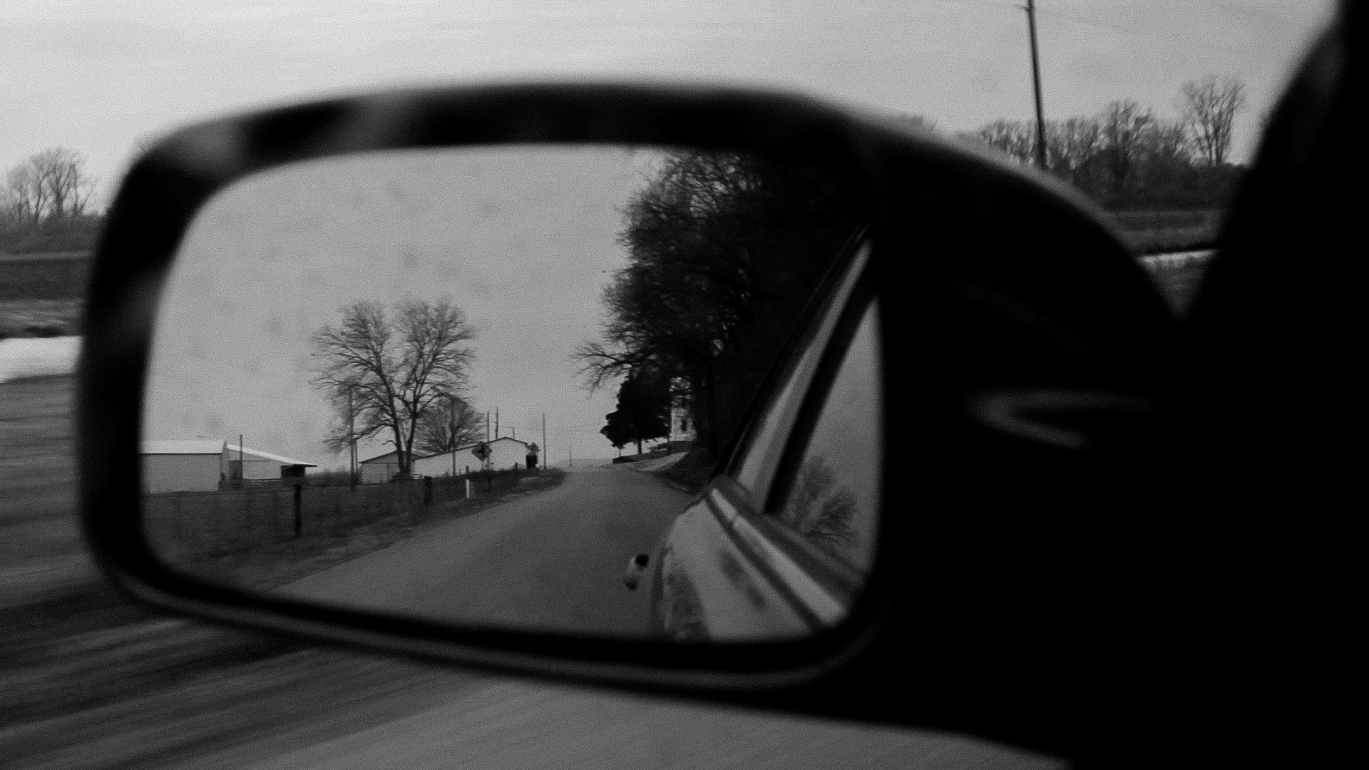
Approaching the Grave—East St. Louis, IL
The Grave—Physical Model [Plaster, Wood, Wire, Paper, Foam, Gauze, Epoxy]
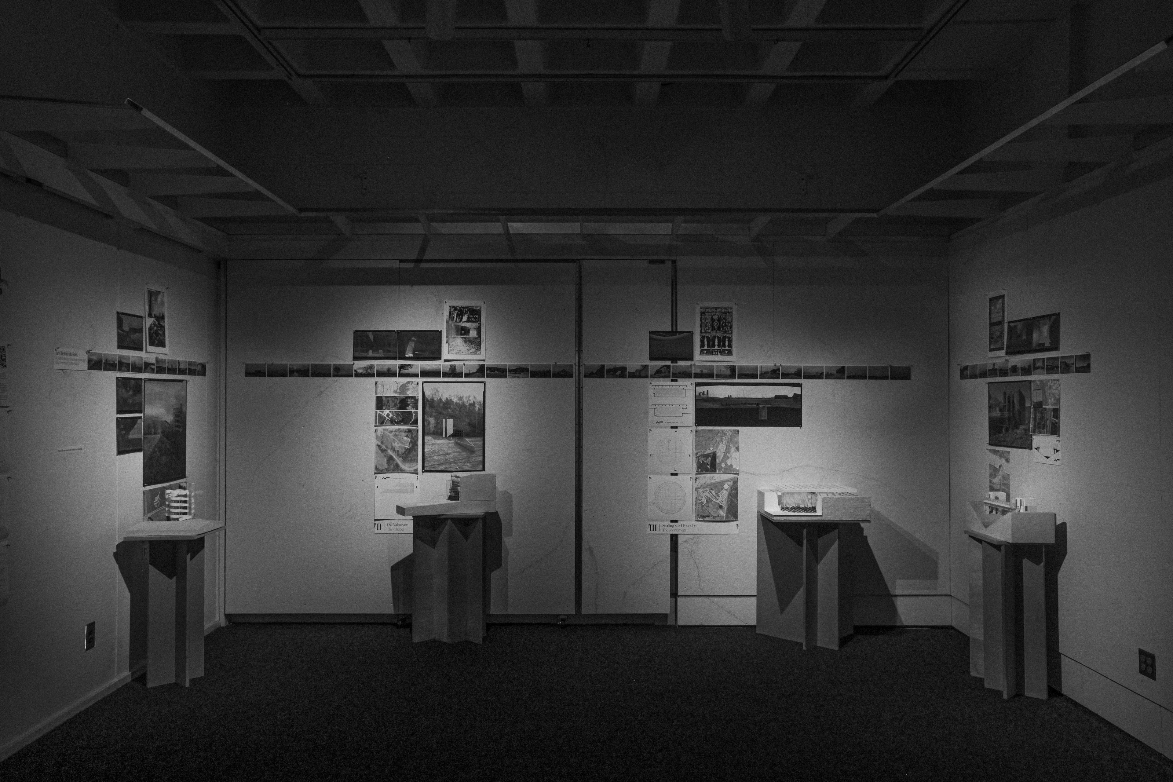
Le Chemin du Rois: A Self-Reflexive Procession through the American Bottomland—Installation View